Frankfurt am Main night lights from space
Night Light of Frankfurt am Main (Hesse) from space (Germany) Src. Average luminocity for 10x10km area is 84.1217% and for 50x50km: 28.233%.
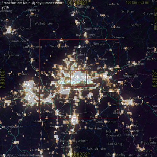
Analysis of Frankfurt am Main night lights 2016
Square area 10x10 km:
 40.51%
90-99
26.74%80-89
2.81%70-79
4.41%60-69
5.08%50-59
3.61%40-49
7.62%30-39
9.22%20-29
0%10-19
0%0-9
0%Square area 50x50 km:
5.58%90-99
5.57%80-89
2.48%70-79
2.7%60-69
3.56%50-59
2.79%40-49
3.99%30-39
4.7%20-29
10%10-19
16.73%0-9
41.9%Clear (daylight) street map image can be seen on geolist.org.
Map coordinates:
50° 33' 51.4" North, 7° 58' 51.8" East
50° 6' 55.9" North, 8° 41' 3" East
49° 39' 45.1" North, 9° 23' 14.3" East
Fantastic image of Frankfurt am Main from space taken by astronauts [src2], but I don't have information about it's orientation, scale or angle. If necessary, it was rotated manually, so North points approximately to upper direction. Click to zoom in:

Some cities around Frankfurt am Main sort by population:
• Offenbach
6.1 km =3.8 mi,  105°
105°
• Gallus
4.2 km =2.6 mi,  246°
246°
• Neu Isenburg
7.5 km =4.7 mi,  174°
174°
• Bad Vilbel
8 km =5 mi,  28°
28°
• Mühlheim am Main
10.6 km =6.6 mi,  89°
89°
• Niederrad
5.4 km =3.4 mi,  227°
227°
• Eschborn
8.6 km =5.3 mi,  290°
290°
• Steinbach am Taunus
9.8 km =6.1 mi,  306°
306°
2925533 (p: 650,000)
Sources (retrieved 2019-11-25):
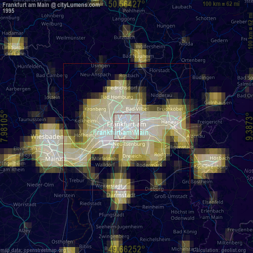
» NASA, Earths city lights 1995
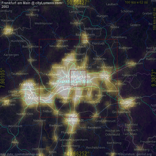
» NASA city lights 2003
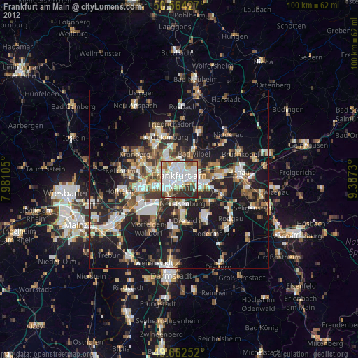
» Earth at Night: Flat Maps 2012, 2016
Src.2: esa.int