Dreieich night lights from space
Night Light of Dreieich (Hesse) from space (Germany) Src. Average luminocity for 10x10km area is 41.5% and for 50x50km: 30.0279%.
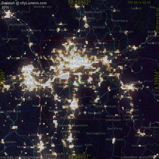
Analysis of Dreieich night lights 2016
Square area 10x10 km:
 6.58%
6.58%90-99
5.74%80-89
6.16%70-79
3.5%60-69
3.64%50-59
4.48%40-49
5.18%30-39
8.96%20-29
33.75%10-19
21.15%0-9
0.84%Square area 50x50 km:
5.98%90-99
5.85%80-89
2.6%70-79
2.98%60-69
3.78%50-59
2.95%40-49
4.08%30-39
4.93%20-29
10.91%10-19
18.5%0-9
37.44%Clear (daylight) street map image can be seen on geolist.org.
Map coordinates:
50° 28' 10.6" North, 7° 59' 34.8" East
50° 1' 11.9" North, 8° 41' 46" East
49° 33' 57.9" North, 9° 23' 57.3" East
Some cities around Dreieich sort by population:
• Langen
3.9 km =2.4 mi,  210°
210°
• Neu Isenburg
3.2 km =2 mi,  357°
357°
• Dietzenbach
5.9 km =3.7 mi,  101°
101°
• Mörfelden-Walldorf
8.5 km =5.3 mi,  250°
250°
• Niederrad
8.5 km =5.3 mi,  325°
325°
• Heusenstamm
8.5 km =5.3 mi,  62°
62°
• Egelsbach
6.2 km =3.9 mi,  201°
201°
• Erzhausen
8 km =5 mi, 205°
2935220 (p: 40,367)
Sources (retrieved 2019-11-25):
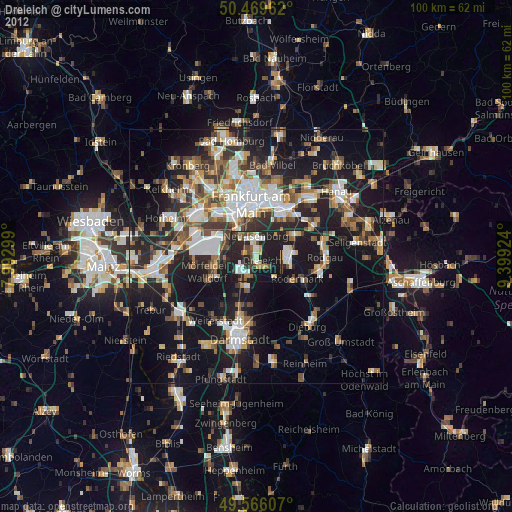
» Earth at Night: Flat Maps 2012, 2016