Offenbach night lights from space
Night Light of Offenbach (Hesse) from space (Germany) Src. Average luminocity for 10x10km area is 68.9626% and for 50x50km: 28.0022%.
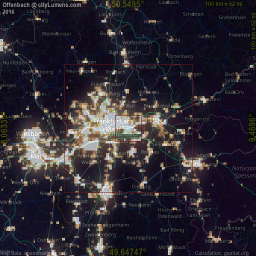
Analysis of Offenbach night lights 2016
Square area 10x10 km:
 21.93%
90-99
21.26%80-89
6.02%70-79
3.88%60-69
6.02%50-59
4.81%40-49
4.01%30-39
23.4%20-29
8.69%10-19
0%0-9
0%Square area 50x50 km:
5.58%90-99
5.52%80-89
2.43%70-79
2.66%60-69
3.67%50-59
2.78%40-49
3.74%30-39
4.57%20-29
9.19%10-19
17.61%0-9
42.23%Clear (daylight) street map image can be seen on geolist.org.
Map coordinates:
50° 32' 58.2" North, 8° 3' 48.1" East
50° 6' 2.2" North, 8° 45' 59.3" East
49° 38' 50.9" North, 9° 28' 10.6" East
Some cities around Offenbach sort by population:
• Frankfurt am Main
6.1 km =3.8 mi,  285°
285°
• Gallus
9.8 km =6.1 mi,  269°
269°
• Maintal
7.3 km =4.5 mi,  40°
40°
• Neu Isenburg
7.8 km =4.8 mi,  221°
221°
• Bad Vilbel
8.9 km =5.5 mi,  346°
346°
• Mühlheim am Main
5.1 km =3.2 mi,  69°
69°
• Obertshausen
6.9 km =4.3 mi,  118°
118°
• Heusenstamm
5.6 km =3.5 mi,  153°
153°
2857807 (p: 119,192)
Sources (retrieved 2019-11-25):
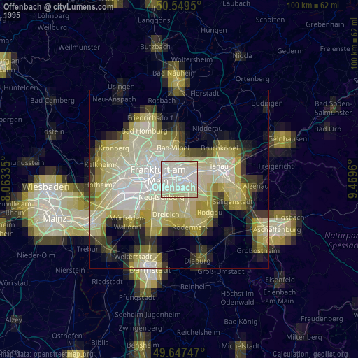
» NASA, Earths city lights 1995
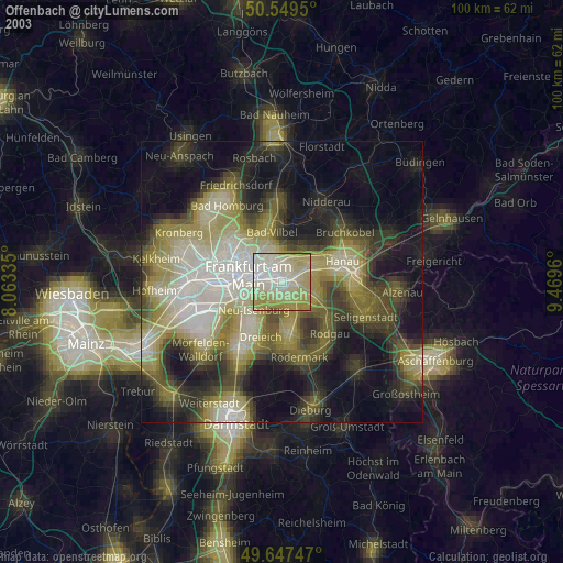
» NASA city lights 2003
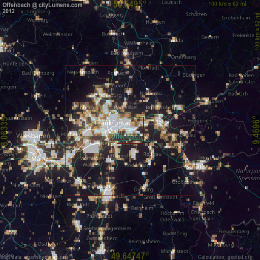
» Earth at Night: Flat Maps 2012, 2016