Neu Isenburg night lights from space
Night Light of Neu Isenburg (Hesse) from space (Germany) Src. Average luminocity for 10x10km area is 45.8655% and for 50x50km: 29.4194%.
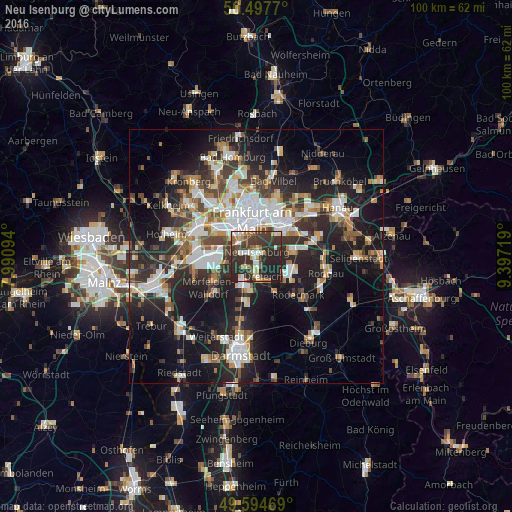
Analysis of Neu Isenburg night lights 2016
Square area 10x10 km:
 6.44%
6.44%90-99
6.86%80-89
6.02%70-79
2.8%60-69
5.46%50-59
5.32%40-49
7.42%30-39
20.59%20-29
31.09%10-19
7.98%0-9
0%Square area 50x50 km:
5.85%90-99
5.76%80-89
2.52%70-79
2.89%60-69
3.63%50-59
2.88%40-49
3.99%30-39
4.81%20-29
10.79%10-19
18.39%0-9
38.5%Clear (daylight) street map image can be seen on geolist.org.
Map coordinates:
50° 29' 51.7" North, 7° 59' 27.4" East
50° 2' 54" North, 8° 41' 38.6" East
49° 35' 40.9" North, 9° 23' 49.9" East
Some cities around Neu Isenburg sort by population:
• Frankfurt am Main
7.5 km =4.7 mi,  354°
354°
• Offenbach
7.8 km =4.8 mi,  41°
41°
• Dreieich
3.2 km =2 mi,  177°
177°
• Gallus
7.4 km =4.6 mi,  321°
321°
• Langen
6.8 km =4.2 mi,  195°
195°
• Dietzenbach
7.4 km =4.6 mi,  125°
125°
• Niederrad
6.1 km =3.8 mi,  309°
309°
• Heusenstamm
7.7 km =4.8 mi,  83°
83°
2864820 (p: 35,293)
Sources (retrieved 2019-11-25):
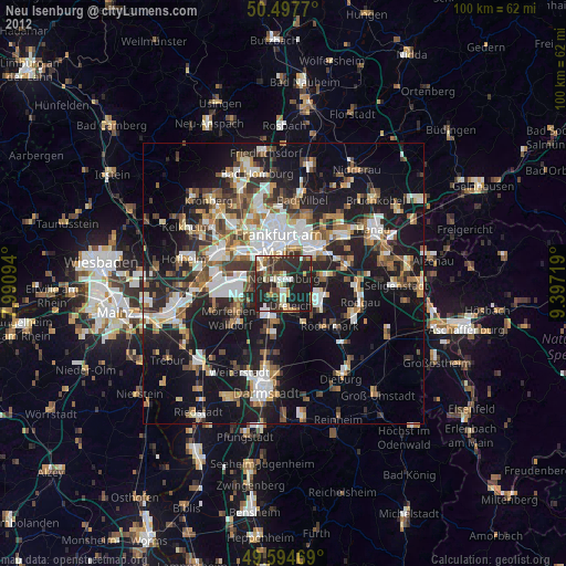
» Earth at Night: Flat Maps 2012, 2016