Neuenrade night lights from space
Night Light of Neuenrade (North Rhine-Westphalia) from space (Germany) Src. Average luminocity for 10x10km area is 2.979% and for 50x50km: 9.4514%.
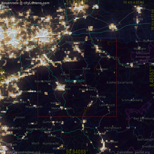
Analysis of Neuenrade night lights 2016
Square area 10x10 km:
 0.14%
0.14%90-99
0.98%80-89
0%70-79
0%60-69
0%50-59
1.26%40-49
0.98%30-39
0%20-29
0.56%10-19
0%0-9
96.08%Square area 50x50 km:
0.95%90-99
1.23%80-89
0.79%70-79
1.12%60-69
1.49%50-59
1.54%40-49
1.85%30-39
1.44%20-29
2.84%10-19
6.85%0-9
79.9%Clear (daylight) street map image can be seen on geolist.org.
Map coordinates:
51° 43' 13.7" North, 7° 4' 45.8" East
51° 16' 58" North, 7° 46' 57" East
50° 50' 27.2" North, 8° 29' 8.3" East
Some cities around Neuenrade sort by population:
• Iserlohn
11.7 km =7.3 mi,  331°
331°
• Hemer
11.6 km =7.2 mi,  355°
355°
• Plettenberg
10.3 km =6.4 mi,  142°
142°
• Altena
7.7 km =4.8 mi,  279°
279°
• Werdohl
2.8 km =1.7 mi,  204°
204°
• Balve
7.9 km =4.9 mi,  46°
46°
• Herscheid
11.9 km =7.4 mi,  193°
193°
• Nachrodt-Wiblingwerde
12.1 km =7.5 mi,  288°
288°
2865592 (p: 12,602)
Sources (retrieved 2019-11-25):
» Earth at Night: Flat Maps 2012, 2016