Altena night lights from space
Night Light of Altena (North Rhine-Westphalia) from space (Germany) Src. Average luminocity for 10x10km area is 3.4566% and for 50x50km: 13.5419%.
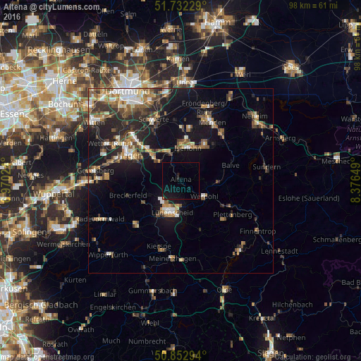
Analysis of Altena night lights 2016
Square area 10x10 km:
 0%
0%90-99
0%80-89
0%70-79
0.28%60-69
0%50-59
0%40-49
0%30-39
0%20-29
0.84%10-19
7.98%0-9
90.9%Square area 50x50 km:
1.54%90-99
1.99%80-89
1.15%70-79
1.73%60-69
2.02%50-59
2.23%40-49
2.4%30-39
2.16%20-29
3.74%10-19
9.94%0-9
71.09%Clear (daylight) street map image can be seen on geolist.org.
Map coordinates:
51° 43' 56.2" North, 6° 58' 12.9" East
51° 17' 41" North, 7° 40' 24.1" East
50° 51' 10.6" North, 8° 22' 35.4" East
Some cities around Altena sort by population:
• Iserlohn
9.2 km =5.7 mi,  12°
12°
• Lüdenscheid
8.9 km =5.5 mi,  201°
201°
• Hemer
12.3 km =7.6 mi,  33°
33°
• Werdohl
7.5 km =4.7 mi,  120°
120°
• Neuenrade
7.7 km =4.8 mi,  99°
99°
• Schalksmühle
11.7 km =7.3 mi,  239°
239°
• Herscheid
13.8 km =8.6 mi,  159°
159°
• Nachrodt-Wiblingwerde
4.6 km =2.9 mi,  301°
301°
2957886 (p: 20,862)
Sources (retrieved 2019-11-25):
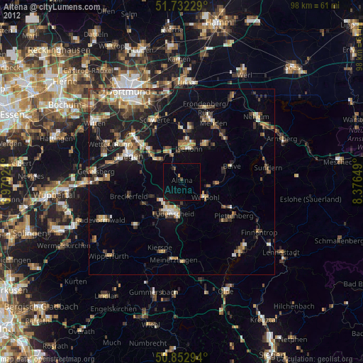
» Earth at Night: Flat Maps 2012, 2016