Herscheid night lights from space
Night Light of Herscheid (North Rhine-Westphalia) from space (Germany) Src. Average luminocity for 10x10km area is 0.9131% and for 50x50km: 6.1204%.
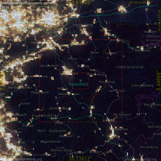
Analysis of Herscheid night lights 2016
Square area 10x10 km:
 0%
0%90-99
0%80-89
0%70-79
0%60-69
0%50-59
0%40-49
0%30-39
0.13%20-29
0.4%10-19
0.67%0-9
98.8%Square area 50x50 km:
0.55%90-99
0.78%80-89
0.57%70-79
0.86%60-69
0.9%50-59
0.97%40-49
1.28%30-39
0.79%20-29
1.15%10-19
4.58%0-9
87.58%Clear (daylight) street map image can be seen on geolist.org.
Map coordinates:
51° 37' 3.7" North, 7° 2' 25.5" East
51° 10' 44.4" North, 7° 44' 36.8" East
50° 44' 10" North, 8° 26' 48" East
Some cities around Herscheid sort by population:
• Lüdenscheid
9.3 km =5.8 mi,  299°
299°
• Plettenberg
9.6 km =6 mi,  69°
69°
• Attendorn
12.6 km =7.8 mi,  117°
117°
• Meinerzhagen
10.4 km =6.5 mi,  219°
219°
• Altena
13.8 km =8.6 mi,  339°
339°
• Werdohl
9.2 km =5.7 mi,  9°
9°
• Kierspe
11.8 km =7.3 mi,  244°
244°
• Neuenrade
11.9 km =7.4 mi, 13°
2905587 (p: 7,658)
Sources (retrieved 2019-11-25):
» Earth at Night: Flat Maps 2012, 2016