Netphen night lights from space
Night Light of Netphen (North Rhine-Westphalia) from space (Germany) Src. Average luminocity for 10x10km area is 9.0224% and for 50x50km: 2.3949%.
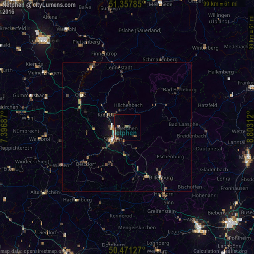
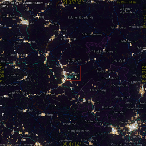
Analysis of Netphen night lights 2016
Square area 10x10 km:
 0.56%
0.56%90-99
1.12%80-89
1.68%70-79
0.14%60-69
2.1%50-59
0.7%40-49
1.54%30-39
0.84%20-29
0.84%10-19
10.08%0-9
80.39%Square area 50x50 km:
0.12%90-99
0.24%80-89
0.21%70-79
0.3%60-69
0.35%50-59
0.34%40-49
0.62%30-39
0.62%20-29
0.5%10-19
1.28%0-9
95.42%Clear (daylight) street map image can be seen on geolist.org.
Map coordinates:
51° 21' 28.3" North, 7° 23' 48.7" East
50° 55' 0" North, 8° 6' 0" East
50° 28' 16.6" North, 8° 48' 11.2" East
Some cities around Netphen sort by population:
• Siegen
7.1 km =4.4 mi,  228°
228°
• Kreuztal
9.7 km =6 mi,  306°
306°
• Wilnsdorf
11.1 km =6.9 mi,  180°
180°
• Freudenberg
16 km =9.9 mi,  262°
262°
• Hilchenbach
8.9 km =5.5 mi,  4°
4°
• Neunkirchen
14.7 km =9.1 mi,  208°
208°
• Erndtebrück
13.4 km =8.3 mi,  52°
52°
• Mudersbach
15 km =9.3 mi, 227°
2866375 (p: 25,163)
Sources (retrieved 2019-11-25):
» Earth at Night: Flat Maps 2012, 2016