Neunkirchen night lights from space
Night Light of Neunkirchen (North Rhine-Westphalia) from space (Germany) Src. Average luminocity for 10x10km area is 3.0868% and for 50x50km: 2.5154%.
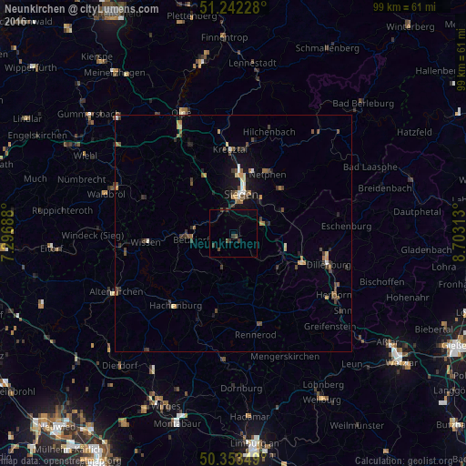
Analysis of Neunkirchen night lights 2016
Square area 10x10 km:
 0%
0%90-99
0%80-89
0%70-79
0%60-69
0%50-59
0.14%40-49
1.82%30-39
2.1%20-29
0.42%10-19
0.7%0-9
94.82%Square area 50x50 km:
0.14%90-99
0.22%80-89
0.23%70-79
0.3%60-69
0.32%50-59
0.48%40-49
0.71%30-39
0.65%20-29
0.5%10-19
1.29%0-9
95.16%Clear (daylight) street map image can be seen on geolist.org.
Map coordinates:
51° 14' 32.2" North, 7° 17' 48.8" East
50° 48' 0" North, 8° 0' 0" East
50° 21' 12.6" North, 8° 42' 11.3" East
Some cities around Neunkirchen sort by population:
• Siegen
8.5 km =5.3 mi,  11°
11°
• Wilnsdorf
7.3 km =4.5 mi,  75°
75°
• Burbach
7.8 km =4.8 mi,  134°
134°
• Betzdorf
9.1 km =5.7 mi,  263°
263°
• Kirchen
8 km =5 mi,  276°
276°
• Herdorf
4.1 km =2.5 mi,  231°
231°
• Mudersbach
4.9 km =3 mi,  305°
305°
• Niederfischbach
10.9 km =6.8 mi,  300°
300°
2864425 (p: 14,225)
Sources (retrieved 2019-11-25):
» Earth at Night: Flat Maps 2012, 2016