Kreuztal night lights from space
Night Light of Kreuztal (North Rhine-Westphalia) from space (Germany) Src. Average luminocity for 10x10km area is 5.9706% and for 50x50km: 2.7252%.
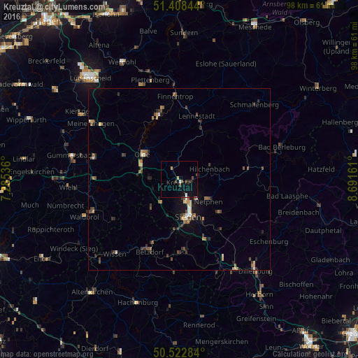
Analysis of Kreuztal night lights 2016
Square area 10x10 km:
 0.56%
0.56%90-99
0.56%80-89
0.42%70-79
0.7%60-69
0%50-59
0.56%40-49
2.1%30-39
0.84%20-29
0.7%10-19
4.06%0-9
89.5%Square area 50x50 km:
0.15%90-99
0.26%80-89
0.24%70-79
0.35%60-69
0.41%50-59
0.45%40-49
0.67%30-39
0.67%20-29
0.58%10-19
1.37%0-9
94.86%Clear (daylight) street map image can be seen on geolist.org.
Map coordinates:
51° 24' 30.4" North, 7° 17' 7.3" East
50° 58' 3.9" North, 7° 59' 18.5" East
50° 31' 22.2" North, 8° 41' 29.8" East
Some cities around Kreuztal sort by population:
• Siegen
10.6 km =6.6 mi,  166°
166°
• Olpe
11.8 km =7.3 mi,  305°
305°
• Netphen
9.7 km =6 mi,  126°
126°
• Wenden
8.5 km =5.3 mi,  269°
269°
• Freudenberg
11.2 km =7 mi,  225°
225°
• Hilchenbach
9.1 km =5.7 mi,  69°
69°
• Kirchhundem
14.9 km =9.3 mi,  28°
28°
• Niederfischbach
15.6 km =9.7 mi,  213°
213°
2884050 (p: 31,772)
Sources (retrieved 2019-11-25):
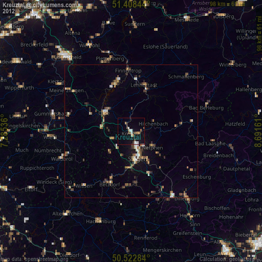
» Earth at Night: Flat Maps 2012, 2016