Nassau night lights from space
Night Light of Nassau (Rheinland-Pfalz) from space (Germany) Src. Average luminocity for 10x10km area is 0.9719% and for 50x50km: 6.6166%.
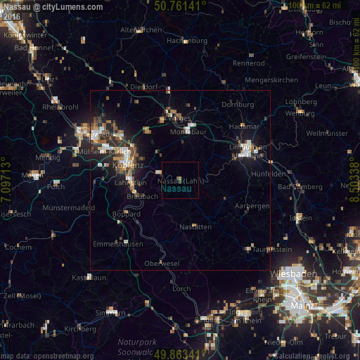
Analysis of Nassau night lights 2016
Square area 10x10 km:
 0%
0%90-99
0%80-89
0%70-79
0.27%60-69
0.27%50-59
0.13%40-49
0.4%30-39
0.53%20-29
0%10-19
0%0-9
98.4%Square area 50x50 km:
0.83%90-99
1.05%80-89
0.52%70-79
0.55%60-69
0.86%50-59
1.23%40-49
1.12%30-39
0.83%20-29
2.08%10-19
4.66%0-9
86.29%Clear (daylight) street map image can be seen on geolist.org.
Map coordinates:
50° 45' 41.1" North, 7° 5' 49.7" East
50° 18' 52.3" North, 7° 48' 0.9" East
49° 51' 48.3" North, 8° 30' 12.2" East
Some cities around Nassau sort by population:
• Koblenz
16.3 km =10.1 mi,  285°
285°
• Lahnstein
13.1 km =8.1 mi,  262°
262°
• Montabaur
13.6 km =8.5 mi,  6°
6°
• Diez
16.1 km =10 mi,  65°
65°
• Höhr-Grenzhausen
16.3 km =10.1 mi,  325°
325°
• Bad Ems
6.6 km =4.1 mi, 290°
• Vallendar
15.4 km =9.6 mi,  305°
305°
• Ransbach-Baumbach
17.5 km =10.9 mi,  343°
343°
2867037 (p: 5,015)
Sources (retrieved 2019-11-25):
» Earth at Night: Flat Maps 2012, 2016