Heiligenhaus night lights from space
Night Light of Heiligenhaus (North Rhine-Westphalia) from space (Germany) Src. Average luminocity for 10x10km area is 28.577% and for 50x50km: 52.1679%.
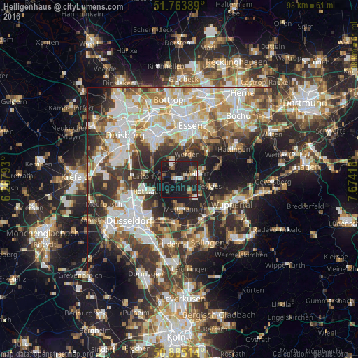
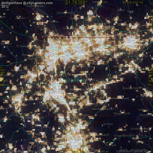
Analysis of Heiligenhaus night lights 2016
Square area 10x10 km:
 3.64%
3.64%90-99
4.34%80-89
0.98%70-79
0.56%60-69
3.64%50-59
5.6%40-49
3.22%30-39
4.2%20-29
11.76%10-19
56.58%0-9
5.46%Square area 50x50 km:
11.91%90-99
12.44%80-89
5.62%70-79
6.3%60-69
6.22%50-59
6.08%40-49
5.98%30-39
8.7%20-29
12.93%10-19
15.14%0-9
8.68%Clear (daylight) street map image can be seen on geolist.org.
Map coordinates:
51° 45' 50" North, 6° 16' 4.5" East
51° 19' 35.8" North, 6° 58' 15.8" East
50° 53' 6.5" North, 7° 40' 27" East
Some cities around Heiligenhaus sort by population:
• Essen
14.7 km =9.1 mi,  11°
11°
• Wuppertal
14.6 km =9.1 mi,  122°
122°
• Mülheim
13.3 km =8.3 mi,  331°
331°
• Ratingen
9.1 km =5.7 mi,  248°
248°
• Velbert
5.1 km =3.2 mi,  79°
79°
• Erkrath
12.4 km =7.7 mi,  200°
200°
• Mettmann
8.5 km =5.3 mi,  177°
177°
• Wülfrath
6.8 km =4.2 mi,  136°
136°
2907585 (p: 27,700)
Sources (retrieved 2019-11-25):
» Earth at Night: Flat Maps 2012, 2016