Mitterteich night lights from space
Night Light of Mitterteich (Bavaria) from space (Germany) Src. Average luminocity for 10x10km area is 0.9762% and for 50x50km: 1.3426%.
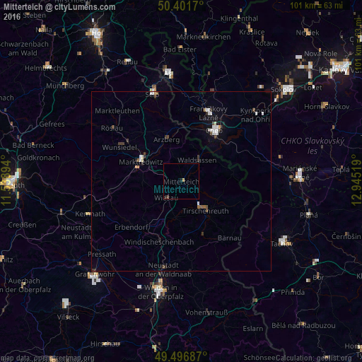
Analysis of Mitterteich night lights 2016
Square area 10x10 km:
 0%
0%90-99
0%80-89
0%70-79
0.56%60-69
0%50-59
0%40-49
0.56%30-39
0%20-29
0.56%10-19
0.56%0-9
97.76%Square area 50x50 km:
0.3%90-99
0.23%80-89
0.04%70-79
0.08%60-69
0.08%50-59
0.09%40-49
0.27%30-39
0.29%20-29
0.13%10-19
0.43%0-9
98.04%Clear (daylight) street map image can be seen on geolist.org.
Map coordinates:
50° 24' 6.1" North, 11° 32' 20.2" East
49° 57' 5.1" North, 12° 14' 31.4" East
49° 29' 48.7" North, 12° 56' 42.7" East
Some cities around Mitterteich sort by population:
• Cheb, CZ
17.1 km =10.6 mi,  33°
33°
• Marktredwitz
12.6 km =7.8 mi,  297°
297°
• Tirschenreuth
10 km =6.2 mi,  140°
140°
• Waldsassen
7.1 km =4.4 mi,  38°
38°
• Berg
16.9 km =10.5 mi,  205°
205°
• Arzberg
12.5 km =7.8 mi,  341°
341°
• Windischeschenbach
17.8 km =11.1 mi,  200°
200°
• Erbendorf
18.7 km =11.6 mi,  228°
228°
2870355 (p: 7,252)
Sources (retrieved 2019-11-25):
» Earth at Night: Flat Maps 2012, 2016