Tirschenreuth night lights from space
Night Light of Tirschenreuth (Bavaria) from space (Germany) Src. Average luminocity for 10x10km area is 2.7479% and for 50x50km: 1.9289%.
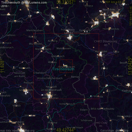
Analysis of Tirschenreuth night lights 2016
Square area 10x10 km:
 0.28%
0.28%90-99
0.28%80-89
0%70-79
0%60-69
0.98%50-59
1.26%40-49
1.12%30-39
0%20-29
0%10-19
0%0-9
96.08%Square area 50x50 km:
0.34%90-99
0.4%80-89
0.09%70-79
0.17%60-69
0.17%50-59
0.19%40-49
0.31%30-39
0.32%20-29
0.24%10-19
0.62%0-9
97.14%Clear (daylight) street map image can be seen on geolist.org.
Map coordinates:
50° 20' 0.9" North, 11° 37' 40.8" East
49° 52' 57.5" North, 12° 19' 52" East
49° 25' 38.8" North, 13° 2' 3.3" East
Some cities around Tirschenreuth sort by population:
• Cheb, CZ
22.1 km =13.7 mi,  7°
7°
• Waldsassen
13.4 km =8.3 mi,  351°
351°
• Berg
15.6 km =9.7 mi,  240°
240°
• Mitterteich
10 km =6.2 mi,  320°
320°
• Neustadt an der Waldnaab
20 km =12.4 mi,  213°
213°
• Arzberg
22 km =13.7 mi,  332°
332°
• Windischeschenbach
15.4 km =9.6 mi,  233°
233°
• Erbendorf
21 km =13 mi,  256°
256°
2822100 (p: 9,410)
Sources (retrieved 2019-11-25):
» Earth at Night: Flat Maps 2012, 2016