Marktredwitz night lights from space
Night Light of Marktredwitz (Bavaria) from space (Germany) Src. Average luminocity for 10x10km area is 4.9244% and for 50x50km: 1.7387%.
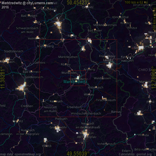
Analysis of Marktredwitz night lights 2016
Square area 10x10 km:
 0.7%
0.7%90-99
0.84%80-89
0.84%70-79
0.98%60-69
0.42%50-59
0.14%40-49
0.42%30-39
0.98%20-29
1.12%10-19
0%0-9
93.56%Square area 50x50 km:
0.32%90-99
0.33%80-89
0.13%70-79
0.14%60-69
0.12%50-59
0.14%40-49
0.37%30-39
0.36%20-29
0.14%10-19
0.42%0-9
97.54%Clear (daylight) street map image can be seen on geolist.org.
Map coordinates:
50° 27' 15.2" North, 11° 22' 58.1" East
50° 0' 15.9" North, 12° 5' 9.3" East
49° 33' 1.4" North, 12° 47' 20.6" East
Some cities around Marktredwitz sort by population:
• Selb
18.7 km =11.6 mi,  9°
9°
• Wunsiedel
7.1 km =4.4 mi,  303°
303°
• Waldsassen
15.6 km =9.7 mi,  91°
91°
• Berg
21.5 km =13.4 mi,  169°
169°
• Mitterteich
12.6 km =7.8 mi,  117°
117°
• Arzberg
9.3 km =5.8 mi,  50°
50°
• Erbendorf
18.5 km =11.5 mi,  188°
188°
• Kemnath
20.5 km =12.7 mi,  223°
223°
2873289 (p: 18,204)
Sources (retrieved 2019-11-25):
» Earth at Night: Flat Maps 2012, 2016