Merchweiler night lights from space
Night Light of Merchweiler (Saarland) from space (Germany) Src. Average luminocity for 10x10km area is 19.1765% and for 50x50km: 17.0715%.
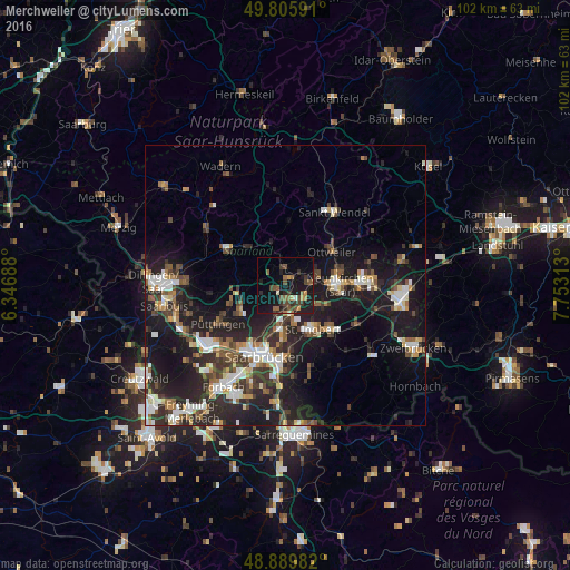
Analysis of Merchweiler night lights 2016
Square area 10x10 km:
 0%
0%90-99
1.34%80-89
0.67%70-79
2.41%60-69
3.34%50-59
4.68%40-49
5.08%30-39
4.55%20-29
7.09%10-19
25.27%0-9
45.59%Square area 50x50 km:
2.45%90-99
2.67%80-89
1.32%70-79
1.58%60-69
1.81%50-59
2.33%40-49
2.87%30-39
3.33%20-29
7.02%10-19
16.11%0-9
58.52%Clear (daylight) street map image can be seen on geolist.org.
Map coordinates:
49° 48' 21.3" North, 6° 20' 48.8" East
49° 21' 0" North, 7° 3' 0" East
48° 53' 23.4" North, 7° 45' 11.3" East
Some cities around Merchweiler sort by population:
• Heusweiler
8.8 km =5.5 mi,  260°
260°
• Illingen
2.6 km =1.6 mi,  356°
356°
• Sulzbach
5.7 km =3.5 mi,  174°
174°
• Eppelborn
8.2 km =5.1 mi,  312°
312°
• Schiffweiler
6.3 km =3.9 mi,  72°
72°
• Spiesen-Elversberg
7.1 km =4.4 mi,  121°
121°
• Quierschied
3.7 km =2.3 mi,  180°
180°
• Friedrichsthal
4.2 km =2.6 mi,  126°
126°
2871832 (p: 10,863)
Sources (retrieved 2019-11-25):
» Earth at Night: Flat Maps 2012, 2016