Mengenich night lights from space
Night Light of Mengenich (North Rhine-Westphalia) from space (Germany) Src. Average luminocity for 10x10km area is 68.5495% and for 50x50km: 37.4652%.
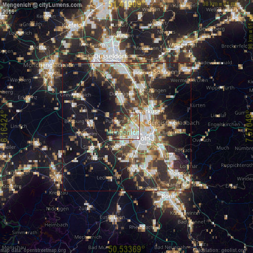
Analysis of Mengenich night lights 2016
Square area 10x10 km:
 14.17%
90-99
17.38%80-89
8.56%70-79
14.71%60-69
11.36%50-59
5.21%40-49
6.42%30-39
10.16%20-29
10.56%10-19
1.47%0-9
0%Square area 50x50 km:
6.77%90-99
7.28%80-89
3.4%70-79
3.98%60-69
5.24%50-59
5.43%40-49
5.75%30-39
8.02%20-29
9.77%10-19
19.42%0-9
24.94%Clear (daylight) street map image can be seen on geolist.org.
Map coordinates:
51° 25' 8.7" North, 6° 9' 51.3" East
50° 58' 42.6" North, 6° 52' 2.5" East
50° 32' 1.3" North, 7° 34' 13.8" East
Some cities around Mengenich sort by population:
• Nippes
6.2 km =3.9 mi,  103°
103°
• Pulheim
4.9 km =3 mi,  298°
298°
• Neustadt/Nord
6.5 km =4 mi,  120°
120°
• Neuehrenfeld
5.3 km =3.3 mi, 115°
• Bilderstoeckchen
4.5 km =2.8 mi, 102°
• Riehl
7.7 km =4.8 mi, 99°
• Ossendorf
2.9 km =1.8 mi,  107°
107°
• Sinnersdorf
6.2 km =3.9 mi,  325°
325°
2871963 (p: 10,350)
Sources (retrieved 2019-11-25):
» Earth at Night: Flat Maps 2012, 2016