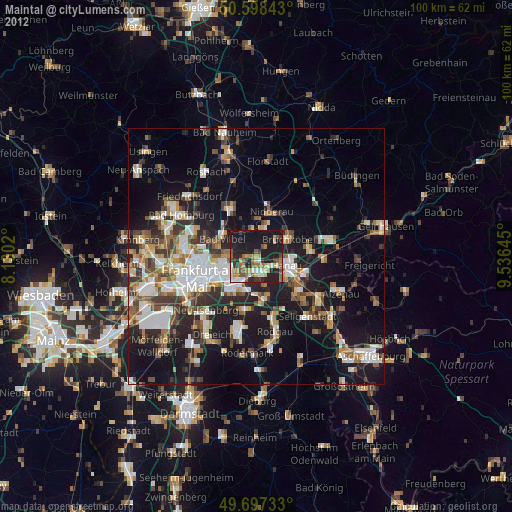
Maintal night lights from space
Night Light of Maintal (Hesse) from space (Germany) Src. Average luminocity for 10x10km area is 39.7968% and for 50x50km: 25.2169%.
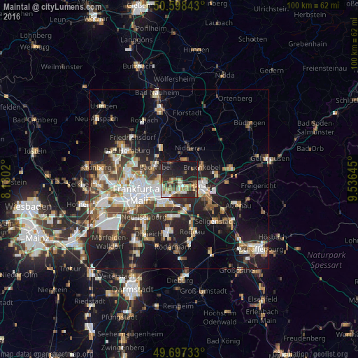
Analysis of Maintal night lights 2016
Square area 10x10 km:
 4.41%
4.41%90-99
6.95%80-89
4.68%70-79
2.67%60-69
6.95%50-59
7.75%40-49
3.61%30-39
8.56%20-29
21.93%10-19
26.34%0-9
6.15%Square area 50x50 km:
5.05%90-99
4.96%80-89
2.27%70-79
2.38%60-69
3.33%50-59
2.61%40-49
3.48%30-39
4.22%20-29
7.28%10-19
15.42%0-9
49.01%Clear (daylight) street map image can be seen on geolist.org.
Map coordinates:
50° 35' 54.3" North, 8° 7' 48.7" East
50° 9' 0" North, 8° 49' 60" East
49° 41' 50.4" North, 9° 32' 11.2" East
Some cities around Maintal sort by population:
• Offenbach
7.3 km =4.5 mi,  220°
220°
• Hanau am Main
6 km =3.7 mi,  106°
106°
• Bad Vilbel
7.5 km =4.7 mi,  295°
295°
• Mühlheim am Main
3.7 km =2.3 mi,  180°
180°
• Obertshausen
8.8 km =5.5 mi,  171°
171°
• Karben
9.9 km =6.2 mi,  333°
333°
• Bruchköbel
7.1 km =4.4 mi,  63°
63°
• Nidderau
10.1 km =6.3 mi,  13°
13°
2874230 (p: 38,313)
Sources (retrieved 2019-11-25):
» Earth at Night: Flat Maps 2012, 2016