Karben night lights from space
Night Light of Karben (Hesse) from space (Germany) Src. Average luminocity for 10x10km area is 12.5735% and for 50x50km: 23.1235%.
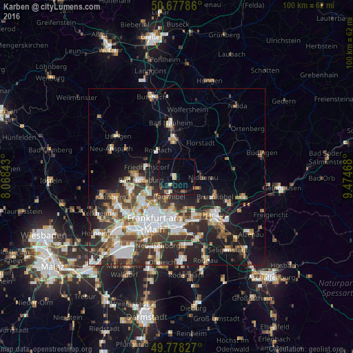
Analysis of Karben night lights 2016
Square area 10x10 km:
 1.2%
1.2%90-99
1.34%80-89
1.2%70-79
1.6%60-69
0.4%50-59
1.6%40-49
1.74%30-39
0.53%20-29
4.28%10-19
17.38%0-9
68.72%Square area 50x50 km:
4.88%90-99
4.79%80-89
2.11%70-79
2.25%60-69
3.03%50-59
2.41%40-49
3.07%30-39
4.06%20-29
7.26%10-19
9.97%0-9
56.18%Clear (daylight) street map image can be seen on geolist.org.
Map coordinates:
50° 40' 40.3" North, 8° 4' 6.3" East
50° 13' 48.7" North, 8° 46' 17.6" East
49° 46' 41.8" North, 9° 28' 28.8" East
Some cities around Karben sort by population:
• Bad Homburg vor der Höhe
10.9 km =6.8 mi,  268°
268°
• Maintal
9.9 km =6.2 mi,  153°
153°
• Bad Vilbel
6.2 km =3.9 mi,  202°
202°
• Friedberg
12 km =7.5 mi,  354°
354°
• Friedrichsdorf
9.4 km =5.8 mi,  283°
283°
• Nidderau
6.8 km =4.2 mi,  82°
82°
• Rosbach vor der Höhe
10 km =6.2 mi,  324°
324°
• Florstadt
11.8 km =7.3 mi,  35°
35°
2892980 (p: 21,642)
Sources (retrieved 2019-11-25):
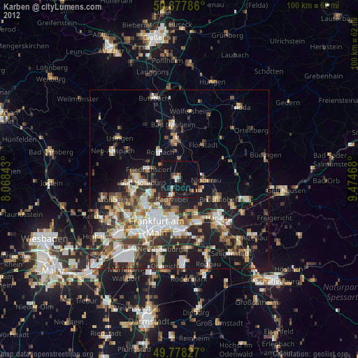
» Earth at Night: Flat Maps 2012, 2016