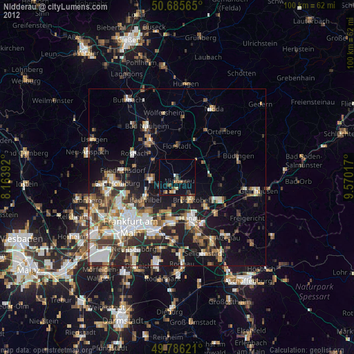
Nidderau night lights from space
Night Light of Nidderau (Hesse) from space (Germany) Src. Average luminocity for 10x10km area is 5.2674% and for 50x50km: 20.1908%.
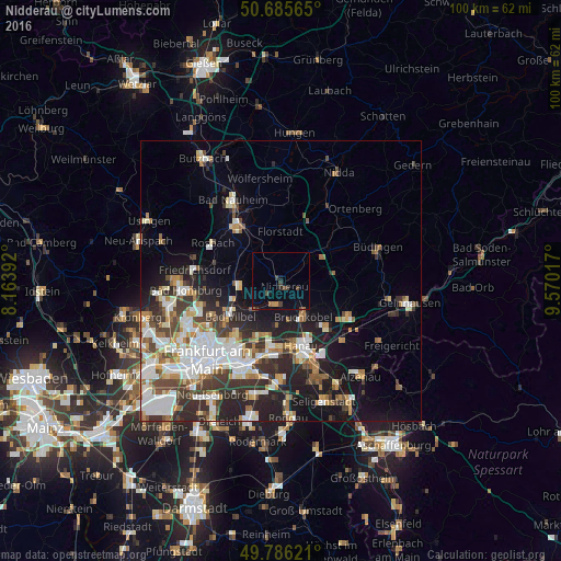
Analysis of Nidderau night lights 2016
Square area 10x10 km:
 0%
0%90-99
0%80-89
0%70-79
1.07%60-69
0.8%50-59
0.4%40-49
2.14%30-39
1.74%20-29
0.8%10-19
1.87%0-9
91.18%Square area 50x50 km:
4.52%90-99
4.29%80-89
1.79%70-79
1.87%60-69
2.57%50-59
2%40-49
2.58%30-39
3.51%20-29
5.57%10-19
8.5%0-9
62.8%Clear (daylight) street map image can be seen on geolist.org.
Map coordinates:
50° 41' 8.3" North, 8° 9' 50.1" East
50° 14' 17" North, 8° 52' 1.3" East
49° 47' 10.4" North, 9° 34' 12.6" East
Some cities around Nidderau sort by population:
• Hanau am Main
12 km =7.5 mi,  163°
163°
• Maintal
10.1 km =6.3 mi,  193°
193°
• Bad Vilbel
11.3 km =7 mi,  234°
234°
• Karben
6.8 km =4.2 mi,  262°
262°
• Bruchköbel
7.7 km =4.8 mi,  148°
148°
• Erlensee
11.5 km =7.1 mi,  136°
136°
• Altenstadt
7.7 km =4.8 mi,  44°
44°
• Florstadt
8.7 km =5.4 mi,  359°
359°
2863712 (p: 20,090)
Sources (retrieved 2019-11-25):
» Earth at Night: Flat Maps 2012, 2016