Bruchköbel night lights from space
Night Light of Bruchköbel (Hesse) from space (Germany) Src. Average luminocity for 10x10km area is 24.5615% and for 50x50km: 20.3627%.
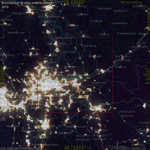
Analysis of Bruchköbel night lights 2016
Square area 10x10 km:
 2.94%
2.94%90-99
3.61%80-89
2.14%70-79
2.01%60-69
4.55%50-59
2.41%40-49
1.47%30-39
2.14%20-29
14.71%10-19
28.21%0-9
35.83%Square area 50x50 km:
4.07%90-99
3.97%80-89
1.91%70-79
1.88%60-69
2.66%50-59
1.96%40-49
2.65%30-39
3.51%20-29
6.15%10-19
12.24%0-9
58.99%Clear (daylight) street map image can be seen on geolist.org.
Map coordinates:
50° 37' 36.1" North, 8° 13' 12.1" East
50° 10' 42.7" North, 8° 55' 23.3" East
49° 43' 34.1" North, 9° 37' 34.6" East
Some cities around Bruchköbel sort by population:
• Hanau am Main
5 km =3.1 mi,  187°
187°
• Maintal
7.1 km =4.4 mi,  243°
243°
• Mühlheim am Main
9.4 km =5.8 mi,  222°
222°
• Nidderau
7.7 km =4.8 mi,  328°
328°
• Erlensee
4.3 km =2.7 mi,  113°
113°
• Langenselbold
8.3 km =5.2 mi,  91°
91°
• Rodenbach
8.5 km =5.3 mi, 112°
• Großkrotzenburg
11.4 km =7.1 mi,  157°
157°
2943573 (p: 20,892)
Sources (retrieved 2019-11-25):
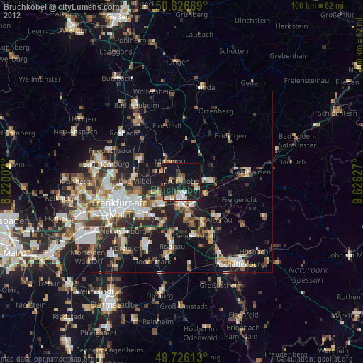
» Earth at Night: Flat Maps 2012, 2016