Wolfsburg night lights from space
Night Light of Wolfsburg (Lower Saxony) from space (Germany) Src. Average luminocity for 10x10km area is 45.3826% and for 50x50km: 6.2016%.
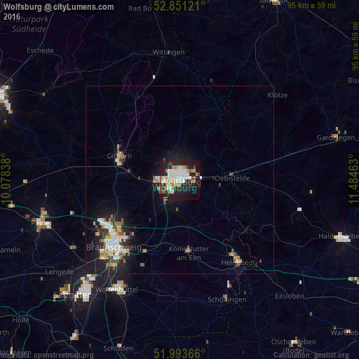
Analysis of Wolfsburg night lights 2016
Square area 10x10 km:
 11.11%
90-99
11.36%80-89
4.04%70-79
4.55%60-69
6.44%50-59
2.4%40-49
2.65%30-39
2.78%20-29
19.32%10-19
26.14%0-9
9.22%Square area 50x50 km:
1.12%90-99
1.18%80-89
0.46%70-79
0.7%60-69
0.76%50-59
0.73%40-49
0.62%30-39
0.55%20-29
1.94%10-19
5.12%0-9
86.82%Clear (daylight) street map image can be seen on geolist.org.
Map coordinates:
52° 51' 4.4" North, 10° 4' 42.2" East
52° 25' 28.3" North, 10° 46' 53.4" East
51° 59' 37.2" North, 11° 29' 4.7" East
Some cities around Wolfsburg sort by population:
• Gifhorn
16.7 km =10.4 mi,  290°
290°
• Königslutter am Elm
19.4 km =12.1 mi,  172°
172°
• Lehre
12.8 km =8 mi,  217°
217°
• Sassenburg
14.3 km =8.9 mi,  315°
315°
• Westhagen
3.6 km =2.2 mi,  231°
231°
• Detmerode
4.6 km =2.9 mi,  213°
213°
• Oebisfelde
14 km =8.7 mi,  85°
85°
• Isenbüttel
13.5 km =8.4 mi,  274°
274°
2806654 (p: 123,064)
Sources (retrieved 2019-11-25):
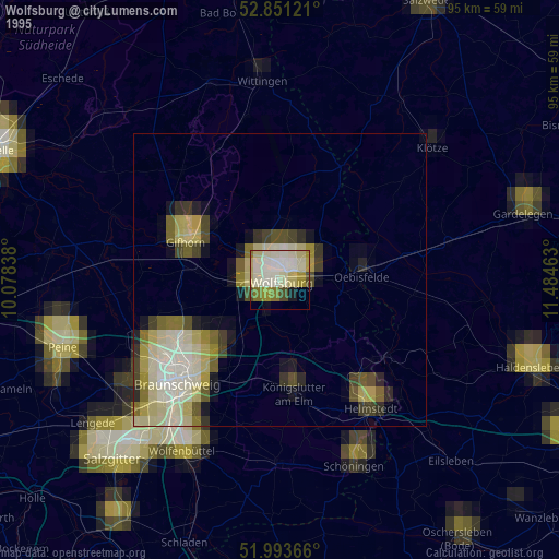
» NASA, Earths city lights 1995
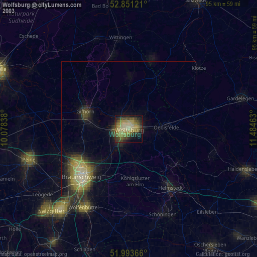
» NASA city lights 2003
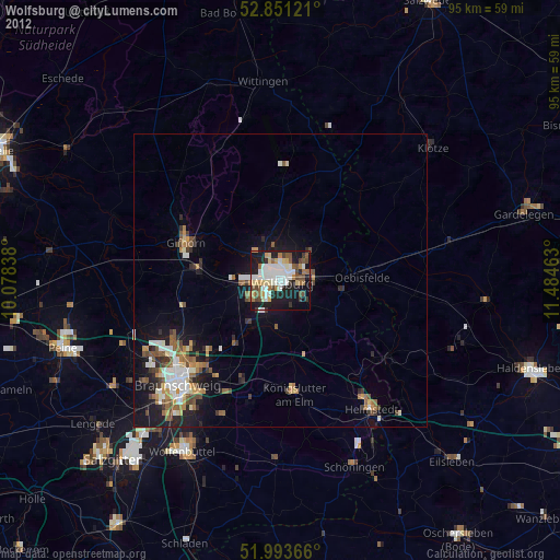
» Earth at Night: Flat Maps 2012, 2016