Ingolstadt night lights from space
Night Light of Ingolstadt (Bavaria) from space (Germany) Src. Average luminocity for 10x10km area is 51.3438% and for 50x50km: 5.1444%.
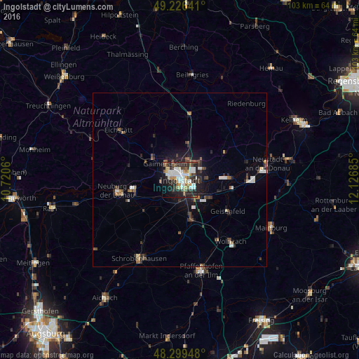
Analysis of Ingolstadt night lights 2016
Square area 10x10 km:
 13.21%
90-99
12.93%80-89
3.69%70-79
4.4%60-69
5.11%50-59
6.25%40-49
5.68%30-39
5.97%20-29
21.31%10-19
16.19%0-9
5.26%Square area 50x50 km:
0.85%90-99
0.85%80-89
0.32%70-79
0.32%60-69
0.56%50-59
0.63%40-49
1%30-39
0.82%20-29
1.64%10-19
2.83%0-9
90.18%Clear (daylight) street map image can be seen on geolist.org.
Map coordinates:
49° 13' 35.1" North, 10° 43' 14.2" East
48° 45' 54.3" North, 11° 25' 25.4" East
48° 17' 58.1" North, 12° 7' 36.7" East
Some cities around Ingolstadt sort by population:
• Neuburg an der Donau
17.7 km =11 mi,  258°
258°
• Manching
7.5 km =4.7 mi,  136°
136°
• Gaimersheim
6.2 km =3.9 mi,  318°
318°
• Geisenfeld
16.5 km =10.3 mi,  123°
123°
• Reichertshofen
12.3 km =7.6 mi,  165°
165°
• Vohburg an der Donau
14.3 km =8.9 mi,  87°
87°
• Rohrbach
19.6 km =12.2 mi,  147°
147°
• Karlshuld
13.7 km =8.5 mi,  227°
227°
2895992 (p: 120,658)
Sources (retrieved 2019-11-25):
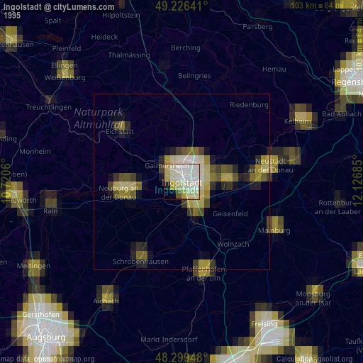
» NASA, Earths city lights 1995
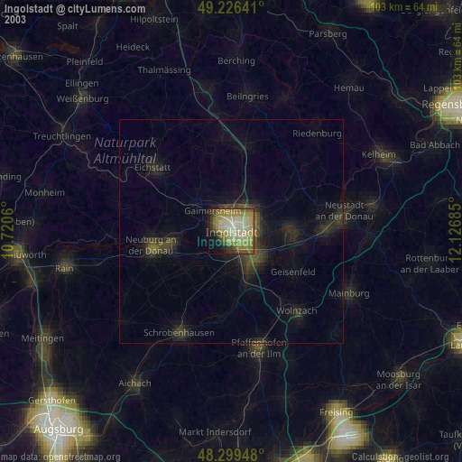
» NASA city lights 2003
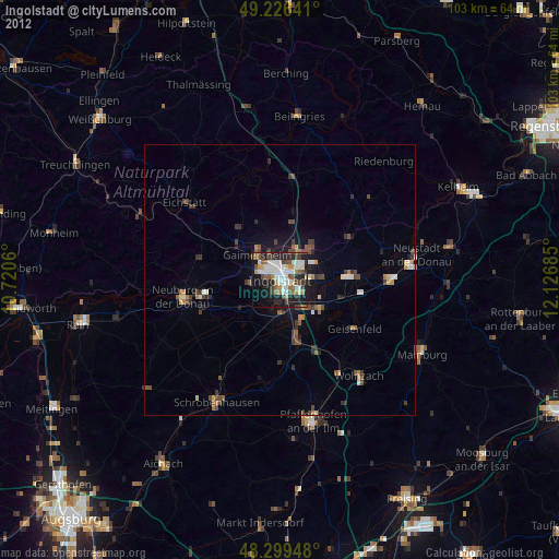
» Earth at Night: Flat Maps 2012, 2016