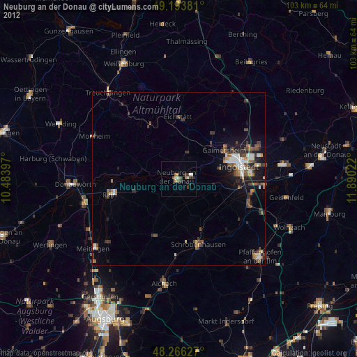
Neuburg an der Donau night lights from space
Night Light of Neuburg an der Donau (Bavaria) from space (Germany) Src. Average luminocity for 10x10km area is 10.8616% and for 50x50km: 4.708%.
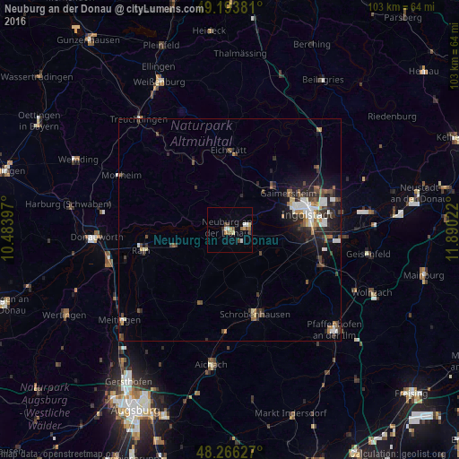
Analysis of Neuburg an der Donau night lights 2016
Square area 10x10 km:
 1.93%
1.93%90-99
1.04%80-89
1.19%70-79
1.79%60-69
1.79%50-59
1.19%40-49
2.53%30-39
1.04%20-29
0%10-19
0.6%0-9
86.9%Square area 50x50 km:
0.77%90-99
0.73%80-89
0.28%70-79
0.37%60-69
0.49%50-59
0.68%40-49
1%30-39
0.91%20-29
1.54%10-19
2.71%0-9
90.51%Clear (daylight) street map image can be seen on geolist.org.
Map coordinates:
49° 11' 37.7" North, 10° 29' 2.3" East
48° 43' 55.8" North, 11° 11' 13.5" East
48° 15' 58.6" North, 11° 53' 24.8" East
Some cities around Neuburg an der Donau sort by population:
• Ingolstadt
17.7 km =11 mi,  78°
78°
• Schrobenhausen
19.8 km =12.3 mi,  164°
164°
• Eichstätt
17.4 km =10.8 mi,  2°
2°
• Gaimersheim
15.7 km =9.8 mi,  57°
57°
• Rain
20.4 km =12.7 mi,  256°
256°
• Pöttmes
18 km =11.2 mi,  203°
203°
• Rennertshofen
10.8 km =6.7 mi,  286°
286°
• Karlshuld
9.1 km =5.7 mi,  127°
127°
2866070 (p: 28,370)
Sources (retrieved 2019-11-25):
» Earth at Night: Flat Maps 2012, 2016