Inden night lights from space
Night Light of Inden (North Rhine-Westphalia) from space (Germany) Src. Average luminocity for 10x10km area is 24.1359% and for 50x50km: 17.1572%.
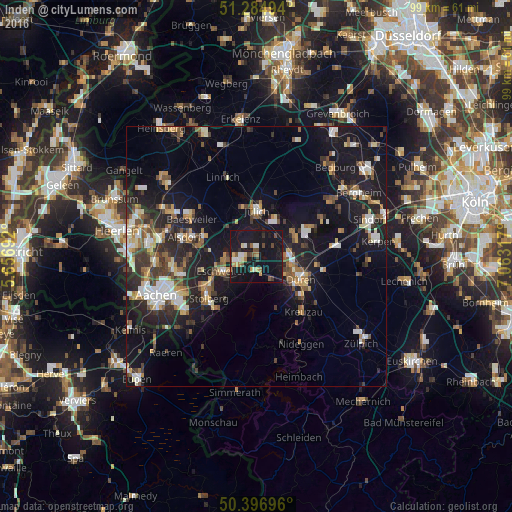
Analysis of Inden night lights 2016
Square area 10x10 km:
 2.1%
2.1%90-99
3.08%80-89
2.24%70-79
2.8%60-69
2.38%50-59
3.36%40-49
3.5%30-39
1.96%20-29
2.66%10-19
59.94%0-9
15.97%Square area 50x50 km:
2.12%90-99
2.87%80-89
1.47%70-79
1.73%60-69
2.03%50-59
2.61%40-49
2.49%30-39
2.56%20-29
5.29%10-19
17.47%0-9
59.35%Clear (daylight) street map image can be seen on geolist.org.
Map coordinates:
51° 17' 5.8" North, 5° 39' 24.9" East
50° 50' 35" North, 6° 21' 36.1" East
50° 23' 49.1" North, 7° 3' 47.4" East
Some cities around Inden sort by population:
• Düren
10.3 km =6.4 mi,  114°
114°
• Stolberg
12.2 km =7.6 mi,  230°
230°
• Eschweiler
6.8 km =4.2 mi,  246°
246°
• Jülich
8.7 km =5.4 mi,  1°
1°
• Kreuzau
14.1 km =8.8 mi,  139°
139°
• Niederzier
8.7 km =5.4 mi,  59°
59°
• Langerwehe
3 km =1.9 mi,  193°
193°
• Aldenhoven
8.3 km =5.2 mi,  319°
319°
2896120 (p: 7,683)
Sources (retrieved 2019-11-25):
» Earth at Night: Flat Maps 2012, 2016