Ilsfeld night lights from space
Night Light of Ilsfeld (Baden-Württemberg) from space (Germany) Src. Average luminocity for 10x10km area is 17.9821% and for 50x50km: 15.7485%.
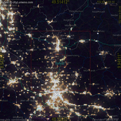
Analysis of Ilsfeld night lights 2016
Square area 10x10 km:
 0.3%
0.3%90-99
1.04%80-89
2.23%70-79
2.38%60-69
0.89%50-59
4.17%40-49
3.87%30-39
2.68%20-29
2.38%10-19
24.11%0-9
55.95%Square area 50x50 km:
1.89%90-99
2.25%80-89
1.44%70-79
1.77%60-69
2.17%50-59
2.32%40-49
2.43%30-39
2.76%20-29
4.77%10-19
11.76%0-9
66.46%Clear (daylight) street map image can be seen on geolist.org.
Map coordinates:
49° 30' 50.8" North, 8° 32' 34.3" East
49° 3' 19.7" North, 9° 14' 45.5" East
48° 35' 33.3" North, 9° 56' 56.8" East
Some cities around Ilsfeld sort by population:
• Heilbronn
9.6 km =6 mi,  348°
348°
• Lauffen am Neckar
7.6 km =4.7 mi,  285°
285°
• Großbottwar
6.9 km =4.3 mi,  150°
150°
• Oberstenfeld
6.4 km =4 mi,  120°
120°
• Untergruppenbach
4.3 km =2.7 mi,  29°
29°
• Flein
5.9 km =3.7 mi,  334°
334°
• Beilstein
5.2 km =3.2 mi,  107°
107°
• Kirchheim am Neckar
7.7 km =4.8 mi,  261°
261°
2896477 (p: 8,214)
Sources (retrieved 2019-11-25):
» Earth at Night: Flat Maps 2012, 2016