Blieskastel night lights from space
Night Light of Blieskastel (Saarland) from space (Germany) Src. Average luminocity for 10x10km area is 5.857% and for 50x50km: 14.6485%.
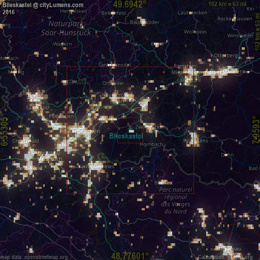
Analysis of Blieskastel night lights 2016
Square area 10x10 km:
 0.67%
0.67%90-99
0.4%80-89
0.53%70-79
0%60-69
0%50-59
0.8%40-49
0.53%30-39
1.07%20-29
1.87%10-19
4.55%0-9
89.57%Square area 50x50 km:
1.82%90-99
2.23%80-89
1.39%70-79
1.42%60-69
1.58%50-59
1.77%40-49
2.32%30-39
2.66%20-29
4.69%10-19
15.19%0-9
64.94%Clear (daylight) street map image can be seen on geolist.org.
Map coordinates:
49° 41' 39.1" North, 6° 33' 11" East
49° 14' 14.1" North, 7° 15' 22.2" East
48° 46' 33.6" North, 7° 57' 33.5" East
Some cities around Blieskastel sort by population:
• Homburg
11.6 km =7.2 mi,  31°
31°
• Sankt Ingbert
11 km =6.8 mi,  293°
293°
• Zweibrücken
8.3 km =5.2 mi,  82°
82°
• Bexbach
12.1 km =7.5 mi,  359°
359°
• Spiesen-Elversberg
12.5 km =7.8 mi,  314°
314°
• Kirkel
5.4 km =3.4 mi,  342°
342°
• Gersheim
10.5 km =6.5 mi,  202°
202°
• Contwig
12.9 km =8 mi, 83°
2947739 (p: 23,212)
Sources (retrieved 2019-11-25):
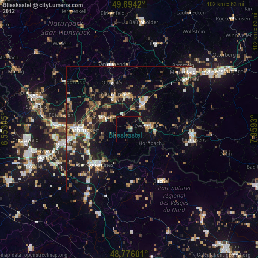
» Earth at Night: Flat Maps 2012, 2016