Hohenstein-Ernstthal night lights from space
Night Light of Hohenstein-Ernstthal (Saxony) from space (Germany) Src. Average luminocity for 10x10km area is 4.0406% and for 50x50km: 9.7385%.
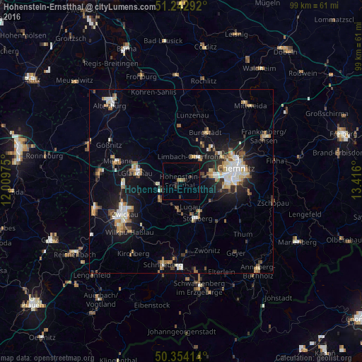
Analysis of Hohenstein-Ernstthal night lights 2016
Square area 10x10 km:
 0%
0%90-99
0%80-89
0.28%70-79
0.28%60-69
1.12%50-59
0.56%40-49
0.28%30-39
1.4%20-29
0.98%10-19
1.82%0-9
93.28%Square area 50x50 km:
1.35%90-99
1.7%80-89
1.06%70-79
1.05%60-69
1.22%50-59
1.41%40-49
0.91%30-39
1.02%20-29
2.24%10-19
6.78%0-9
81.25%Clear (daylight) street map image can be seen on geolist.org.
Map coordinates:
51° 14' 34.5" North, 12° 0' 35.1" East
50° 48' 2.3" North, 12° 42' 46.3" East
50° 21' 14.9" North, 13° 24' 57.6" East
Some cities around Hohenstein-Ernstthal sort by population:
• Limbach-Oberfrohna
7.3 km =4.5 mi,  27°
27°
• Lichtenstein
7.6 km =4.7 mi,  229°
229°
• Stollberg
11.1 km =6.9 mi,  154°
154°
• Oelsnitz
8.4 km =5.2 mi,  185°
185°
• Lugau
7.4 km =4.6 mi,  160°
160°
• Neukirchen
11.1 km =6.9 mi,  102°
102°
• Oberlungwitz
2.1 km =1.3 mi, 189°
• Callenberg
7.8 km =4.8 mi,  314°
314°
2901420 (p: 16,542)
Sources (retrieved 2019-11-25):
» Earth at Night: Flat Maps 2012, 2016