Charlottenburg night lights from space
Night Light of Charlottenburg (Berlin) from space (Germany) Src. Average luminocity for 10x10km area is 87.2024% and for 50x50km: 38.0569%.
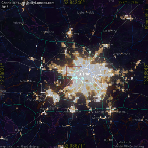
Analysis of Charlottenburg night lights 2016
Square area 10x10 km:
 49.07%
90-99
25%80-89
3.31%70-79
3.04%60-69
4.5%50-59
1.46%40-49
4.89%30-39
7.01%20-29
1.72%10-19
0%0-9
0%Square area 50x50 km:
11.14%90-99
9.61%80-89
3.71%70-79
2.96%60-69
3.24%50-59
3.35%40-49
3.78%30-39
4.26%20-29
8.64%10-19
14.82%0-9
34.49%Clear (daylight) street map image can be seen on geolist.org.
Map coordinates:
52° 56' 32.9" North, 12° 34' 48.8" East
52° 31' 0" North, 13° 16' 60" East
52° 5' 12.2" North, 13° 59' 11.3" East
Some cities around Charlottenburg sort by population:
• Wilmersdorf
4.3 km =2.7 mi,  148°
148°
• Moabit
3.9 km =2.4 mi,  74°
74°
• Westend
0.5 km =0.3 mi,  275°
275°
• Haselhorst
4.4 km =2.7 mi,  314°
314°
• Halensee
3.1 km =1.9 mi,  163°
163°
• Siemensstadt
3 km =1.9 mi,  332°
332°
• Grunewald
3.9 km =2.4 mi,  197°
197°
• Hansaviertel
4 km =2.5 mi,  87°
87°
2940187 (p: 119,857)
Sources (retrieved 2019-11-25):
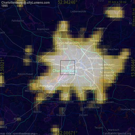
» NASA, Earths city lights 1995
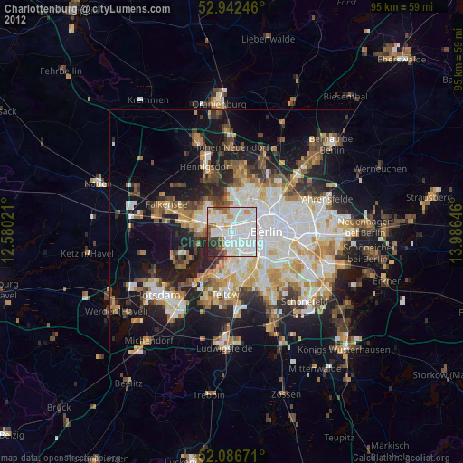
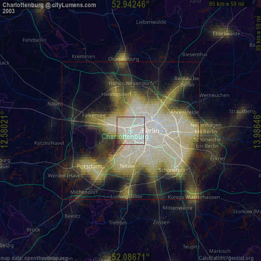
» NASA city lights 2003
» Earth at Night: Flat Maps 2012, 2016