Geesthacht night lights from space
Night Light of Geesthacht (Schleswig-Holstein) from space (Germany) Src. Average luminocity for 10x10km area is 9.8968% and for 50x50km: 12.3532%.
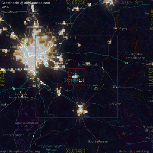
Analysis of Geesthacht night lights 2016
Square area 10x10 km:
 1.32%
1.32%90-99
2.51%80-89
0.93%70-79
0%60-69
1.06%50-59
0.66%40-49
3.57%30-39
1.06%20-29
0%10-19
0.66%0-9
88.23%Square area 50x50 km:
3.06%90-99
2.81%80-89
1.03%70-79
1.22%60-69
1.53%50-59
1.41%40-49
1.55%30-39
1.23%20-29
2.08%10-19
5.29%0-9
78.79%Clear (daylight) street map image can be seen on geolist.org.
Map coordinates:
53° 51' 9.2" North, 9° 40' 29.2" East
53° 26' 8.7" North, 10° 22' 40.4" East
53° 0' 53.3" North, 11° 4' 51.7" East
Some cities around Geesthacht sort by population:
• Bergedorf
11.3 km =7 mi,  298°
298°
• Winsen
14 km =8.7 mi,  231°
231°
• Reinbek
12.4 km =7.7 mi,  316°
316°
• Schwarzenbek
10.1 km =6.3 mi,  42°
42°
• Wentorf bei Hamburg
11.1 km =6.9 mi,  310°
310°
• Lauenburg
13.8 km =8.6 mi,  120°
120°
• Bardowick
15.8 km =9.8 mi,  177°
177°
• Büchen
16.6 km =10.3 mi,  72°
72°
2922102 (p: 29,487)
Sources (retrieved 2019-11-25):
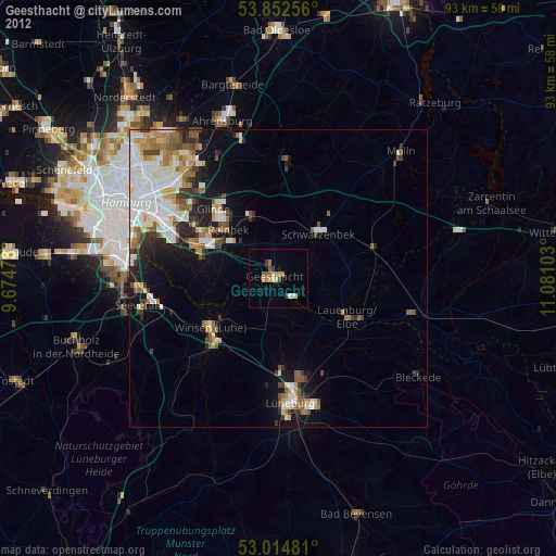
» Earth at Night: Flat Maps 2012, 2016