Lauenburg night lights from space
Night Light of Lauenburg (Schleswig-Holstein) from space (Germany) Src. Average luminocity for 10x10km area is 0.8426% and for 50x50km: 3.7432%.
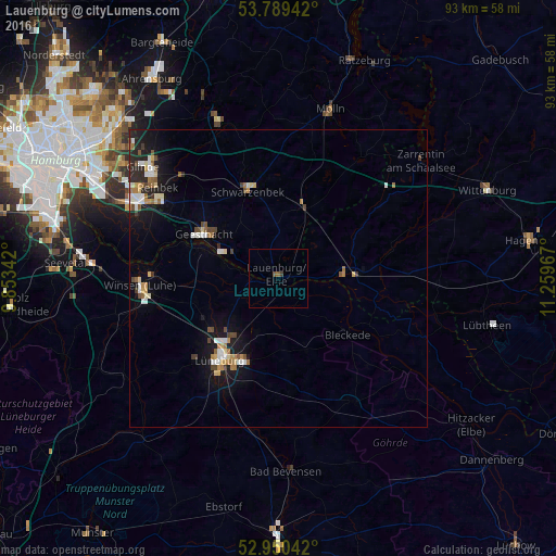
Analysis of Lauenburg night lights 2016
Square area 10x10 km:
 0%
0%90-99
0%80-89
0%70-79
0%60-69
0%50-59
1.06%40-49
0.26%30-39
0.26%20-29
0%10-19
0%0-9
98.41%Square area 50x50 km:
0.53%90-99
0.57%80-89
0.45%70-79
0.36%60-69
0.55%50-59
0.41%40-49
0.56%30-39
0.27%20-29
0.78%10-19
2.84%0-9
92.67%Clear (daylight) street map image can be seen on geolist.org.
Map coordinates:
53° 47' 21.9" North, 9° 51' 12.3" East
53° 22' 19.2" North, 10° 33' 23.5" East
52° 57' 1.5" North, 11° 15' 34.8" East
Some cities around Lauenburg sort by population:
• Lüneburg
16.5 km =10.3 mi,  215°
215°
• Geesthacht
13.8 km =8.6 mi,  300°
300°
• Schwarzenbek
15.4 km =9.6 mi,  340°
340°
• Boizenburg
11.1 km =6.9 mi,  84°
84°
• Adendorf
12.7 km =7.9 mi, 218°
• Bleckede
14.9 km =9.3 mi,  127°
127°
• Bardowick
14.2 km =8.8 mi,  232°
232°
• Büchen
12.7 km =7.9 mi,  18°
18°
2880181 (p: 11,814)
Sources (retrieved 2019-11-25):
» Earth at Night: Flat Maps 2012, 2016