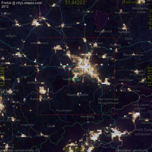
Freital night lights from space
Night Light of Freital (Saxony) from space (Germany) Src. Average luminocity for 10x10km area is 35.9171% and for 50x50km: 10.784%.
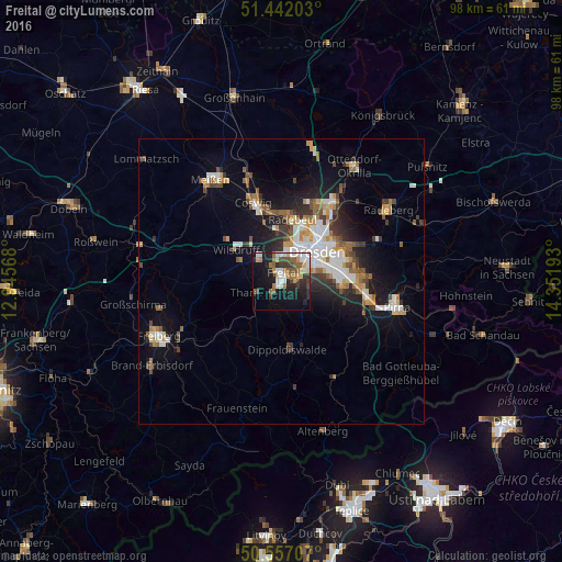
Analysis of Freital night lights 2016
Square area 10x10 km:
 6.68%
6.68%90-99
6.68%80-89
3.48%70-79
3.74%60-69
4.55%50-59
6.55%40-49
3.74%30-39
5.35%20-29
10.03%10-19
22.86%0-9
26.34%Square area 50x50 km:
1.88%90-99
1.93%80-89
0.85%70-79
1.32%60-69
1.27%50-59
1.57%40-49
1.31%30-39
1.59%20-29
2.29%10-19
6.83%0-9
79.15%Clear (daylight) street map image can be seen on geolist.org.
Map coordinates:
51° 26' 31.3" North, 12° 56' 44.4" East
51° 0' 6" North, 13° 38' 55.7" East
50° 33' 25.5" North, 14° 21' 6.9" East
Some cities around Freital sort by population:
• Dresden
8.3 km =5.2 mi,  48°
48°
• Radebeul
11.7 km =7.3 mi,  4°
4°
• Coswig
15.2 km =9.4 mi,  342°
342°
• Wilsdruff
9.6 km =6 mi,  305°
305°
• Dippoldiswalde
11.8 km =7.3 mi,  173°
173°
• Bannewitz
4.9 km =3 mi,  101°
101°
• Klipphausen
12 km =7.5 mi, 308°
• Tharandt
5.1 km =3.2 mi,  249°
249°
2925017 (p: 39,027)
Sources (retrieved 2019-11-25):
» Earth at Night: Flat Maps 2012, 2016