Bannewitz night lights from space
Night Light of Bannewitz (Saxony) from space (Germany) Src. Average luminocity for 10x10km area is 38.0602% and for 50x50km: 10.2888%.
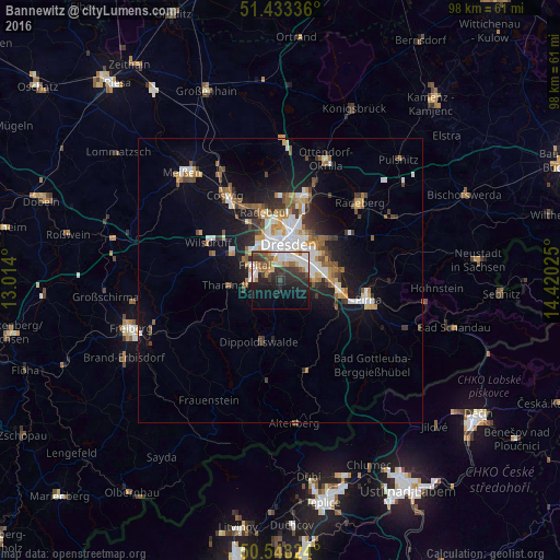
Analysis of Bannewitz night lights 2016
Square area 10x10 km:
 7.22%
7.22%90-99
8.29%80-89
3.21%70-79
3.21%60-69
2.94%50-59
6.28%40-49
3.88%30-39
10.43%20-29
13.5%10-19
18.85%0-9
22.19%Square area 50x50 km:
1.84%90-99
1.86%80-89
0.79%70-79
1.23%60-69
1.17%50-59
1.48%40-49
1.27%30-39
1.62%20-29
2.24%10-19
6.46%0-9
80.03%Clear (daylight) street map image can be seen on geolist.org.
Map coordinates:
51° 26' 0.1" North, 13° 0' 50.4" East
50° 59' 34.5" North, 13° 43' 1.6" East
50° 32' 53.7" North, 14° 25' 12.9" East
Some cities around Bannewitz sort by population:
• Dresden
6.6 km =4.1 mi,  12°
12°
• Freital
4.9 km =3 mi,  281°
281°
• Radebeul
13.2 km =8.2 mi,  342°
342°
• Heidenau
10.8 km =6.7 mi,  102°
102°
• Wilsdruff
14.2 km =8.8 mi,  297°
297°
• Dippoldiswalde
11.3 km =7 mi,  197°
197°
• Dohna
10.7 km =6.6 mi,  112°
112°
• Tharandt
9.6 km =6 mi,  264°
264°
2952916 (p: 10,851)
Sources (retrieved 2019-11-25):
» Earth at Night: Flat Maps 2012, 2016