Coswig night lights from space
Night Light of Coswig (Saxony) from space (Germany) Src. Average luminocity for 10x10km area is 17.6618% and for 50x50km: 11.2382%.
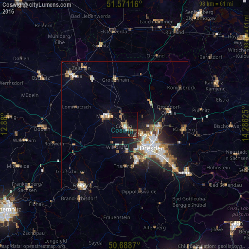
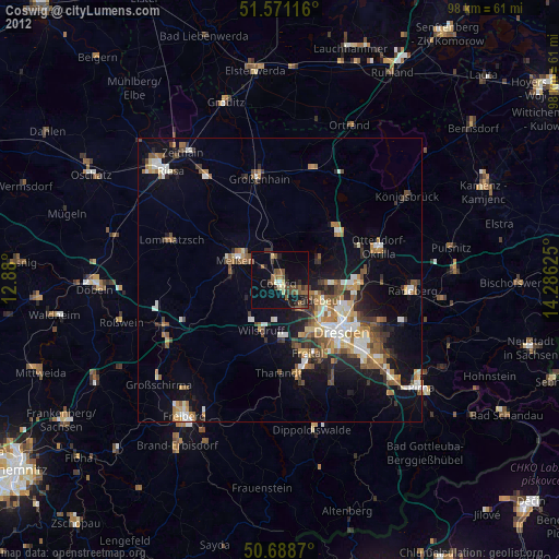
Analysis of Coswig night lights 2016
Square area 10x10 km:
 1.34%
1.34%90-99
1.2%80-89
0.67%70-79
1.34%60-69
3.48%50-59
5.08%40-49
3.74%30-39
0.8%20-29
2.27%10-19
21.26%0-9
58.82%Square area 50x50 km:
1.91%90-99
2.06%80-89
0.95%70-79
1.38%60-69
1.37%50-59
1.6%40-49
1.34%30-39
1.61%20-29
2.26%10-19
6.83%0-9
78.69%Clear (daylight) street map image can be seen on geolist.org.
Map coordinates:
51° 34' 16.2" North, 12° 52' 48" East
51° 7' 55.3" North, 13° 34' 59.2" East
50° 41' 19.3" North, 14° 17' 10.5" East
Some cities around Coswig sort by population:
• Radebeul
6.1 km =3.8 mi,  117°
117°
• Meissen
8.3 km =5.2 mi,  293°
293°
• Wilsdruff
9.5 km =5.9 mi,  200°
200°
• Weinböhla
4 km =2.5 mi,  343°
343°
• Moritzburg
7.4 km =4.6 mi,  65°
65°
• Radeburg
13.7 km =8.5 mi,  47°
47°
• Klipphausen
8.6 km =5.3 mi,  214°
214°
• Ebersbach
12.2 km =7.6 mi,  22°
22°
2939820 (p: 22,304)
Sources (retrieved 2019-11-25):
» Earth at Night: Flat Maps 2012, 2016