Eitorf night lights from space
Night Light of Eitorf (North Rhine-Westphalia) from space (Germany) Src. Average luminocity for 10x10km area is 2.0308% and for 50x50km: 8.6711%.
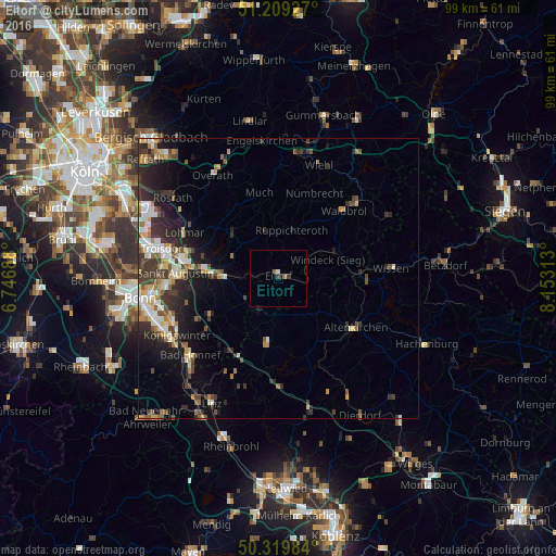
Analysis of Eitorf night lights 2016
Square area 10x10 km:
 0%
0%90-99
0.56%80-89
0%70-79
0%60-69
1.12%50-59
0%40-49
0.14%30-39
0.98%20-29
0.56%10-19
0%0-9
96.64%Square area 50x50 km:
1.06%90-99
1.53%80-89
1%70-79
0.87%60-69
1.17%50-59
1.16%40-49
1.18%30-39
2.3%20-29
2.79%10-19
4.49%0-9
82.45%Clear (daylight) street map image can be seen on geolist.org.
Map coordinates:
51° 12' 33.4" North, 6° 44' 48.8" East
50° 46' 0" North, 7° 27' 0" East
50° 19' 11.4" North, 8° 9' 11.3" East
Some cities around Eitorf sort by population:
• Hennef
11.8 km =7.3 mi,  274°
274°
• Siegburg
17.4 km =10.8 mi,  282°
282°
• Waldbröl
16.9 km =10.5 mi,  44°
44°
• Nümbrecht
16.6 km =10.3 mi,  22°
22°
• Much
15.6 km =9.7 mi,  347°
347°
• Ruppichteroth
8.9 km =5.5 mi, 15°
• Asbach
11.4 km =7.1 mi,  191°
191°
• Altenkirchen
16.2 km =10.1 mi,  123°
123°
2931361 (p: 19,761)
Sources (retrieved 2019-11-25):
» Earth at Night: Flat Maps 2012, 2016