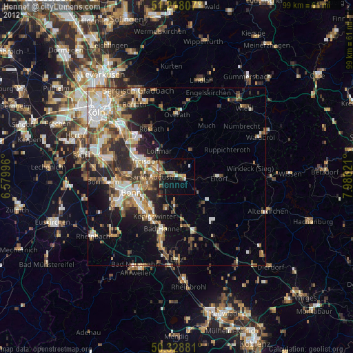
Hennef night lights from space
Night Light of Hennef (North Rhine-Westphalia) from space (Germany) Src. Average luminocity for 10x10km area is 17.5378% and for 50x50km: 18.617%.
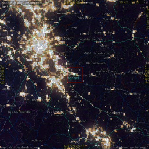
Analysis of Hennef night lights 2016
Square area 10x10 km:
 1.68%
1.68%90-99
2.1%80-89
1.82%70-79
0.56%60-69
4.48%50-59
2.24%40-49
1.82%30-39
2.66%20-29
4.9%10-19
20.45%0-9
57.28%Square area 50x50 km:
3.46%90-99
3.78%80-89
1.95%70-79
1.68%60-69
2.76%50-59
2.56%40-49
2.37%30-39
3.95%20-29
5.16%10-19
6.65%0-9
65.66%Clear (daylight) street map image can be seen on geolist.org.
Map coordinates:
51° 13' 5.1" North, 6° 34' 47.9" East
50° 46' 32" North, 7° 16' 59.1" East
50° 19' 43.7" North, 7° 59' 10.4" East
Some cities around Hennef sort by population:
• Bonn
14 km =8.7 mi,  250°
250°
• Troisdorf
10.1 km =6.3 mi,  291°
291°
• Sankt Augustin
6.1 km =3.8 mi,  269°
269°
• Königswinter
12.3 km =7.6 mi,  213°
213°
• Siegburg
6 km =3.7 mi,  297°
297°
• Lohmar
8.5 km =5.3 mi,  325°
325°
• Rösrath
15.1 km =9.4 mi, 331°
• Eitorf
11.8 km =7.3 mi,  94°
94°
2906376 (p: 45,409)
Sources (retrieved 2019-11-25):
» Earth at Night: Flat Maps 2012, 2016