Much night lights from space
Night Light of Much (North Rhine-Westphalia) from space (Germany) Src. Average luminocity for 10x10km area is 0.0336% and for 50x50km: 11.2693%.
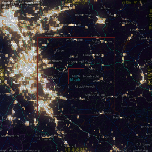
Analysis of Much night lights 2016
Square area 10x10 km:
 0%
0%90-99
0%80-89
0%70-79
0%60-69
0%50-59
0%40-49
0%30-39
0%20-29
0%10-19
0%0-9
100%Square area 50x50 km:
1.66%90-99
2.04%80-89
1.12%70-79
1.08%60-69
1.48%50-59
1.75%40-49
1.57%30-39
3.06%20-29
3.95%10-19
4.93%0-9
77.35%Clear (daylight) street map image can be seen on geolist.org.
Map coordinates:
51° 20' 42.5" North, 6° 41' 59.8" East
50° 54' 13.8" North, 7° 24' 11" East
50° 27' 29.9" North, 8° 6' 22.3" East
Some cities around Much sort by population:
• Lohmar
15.1 km =9.4 mi,  241°
241°
• Overath
9 km =5.6 mi,  291°
291°
• Wiehl
11.5 km =7.1 mi,  63°
63°
• Lindlar
13 km =8.1 mi,  352°
352°
• Engelskirchen
9.4 km =5.8 mi,  4°
4°
• Waldbröl
15.3 km =9.5 mi,  101°
101°
• Nümbrecht
9.6 km =6 mi,  89°
89°
• Ruppichteroth
8.8 km =5.5 mi,  139°
139°
2868936 (p: 15,231)
Sources (retrieved 2019-11-25):
» Earth at Night: Flat Maps 2012, 2016