Brakel night lights from space
Night Light of Brakel (North Rhine-Westphalia) from space (Germany) Src. Average luminocity for 10x10km area is 0.944% and for 50x50km: 1.0199%.
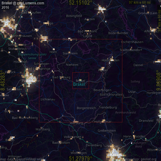
Analysis of Brakel night lights 2016
Square area 10x10 km:
 0%
0%90-99
0%80-89
0%70-79
0.56%60-69
0%50-59
0.56%40-49
0%30-39
0.56%20-29
0%10-19
0%0-9
98.32%Square area 50x50 km:
0.07%90-99
0.06%80-89
0.12%70-79
0.16%60-69
0.19%50-59
0.24%40-49
0.24%30-39
0.13%20-29
0.1%10-19
0.31%0-9
98.38%Clear (daylight) street map image can be seen on geolist.org.
Map coordinates:
52° 9' 3.7" North, 8° 28' 58.2" East
51° 43' 3" North, 9° 11' 9.5" East
51° 16' 47.2" North, 9° 53' 20.7" East
Some cities around Brakel sort by population:
• Höxter
14.9 km =9.3 mi,  64°
64°
• Bad Driburg
11.6 km =7.2 mi,  278°
278°
• Beverungen
14.1 km =8.8 mi,  112°
112°
• Altenbeken
17.6 km =10.9 mi,  287°
287°
• Borgentreich
16.9 km =10.5 mi,  167°
167°
• Schieder-Schwalenberg
17.8 km =11.1 mi,  2°
2°
• Willebadessen
14.5 km =9 mi,  225°
225°
• Nieheim
10.9 km =6.8 mi,  332°
332°
2945542 (p: 17,808)
Sources (retrieved 2019-11-25):
» Earth at Night: Flat Maps 2012, 2016