Borgentreich night lights from space
Night Light of Borgentreich (North Rhine-Westphalia) from space (Germany) Src. Average luminocity for 10x10km area is 0% and for 50x50km: 1.1828%.
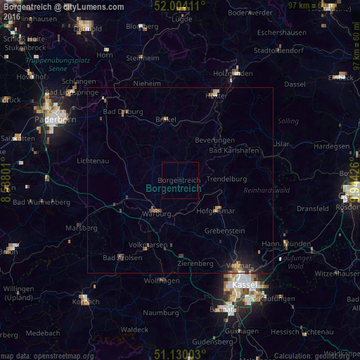
Analysis of Borgentreich night lights 2016
Square area 10x10 km:
 0%
0%90-99
0%80-89
0%70-79
0%60-69
0%50-59
0%40-49
0%30-39
0%20-29
0%10-19
0%0-9
100%Square area 50x50 km:
0.02%90-99
0.04%80-89
0.06%70-79
0.24%60-69
0.22%50-59
0.26%40-49
0.22%30-39
0.27%20-29
0.48%10-19
1%0-9
97.18%Clear (daylight) street map image can be seen on geolist.org.
Map coordinates:
52° 0' 14.8" North, 8° 32' 16.8" East
51° 34' 9" North, 9° 14' 28.1" East
51° 7' 48.1" North, 9° 56' 39.3" East
Some cities around Borgentreich sort by population:
• Warburg
11 km =6.8 mi,  216°
216°
• Brakel
16.9 km =10.5 mi,  347°
347°
• Hofgeismar
12.8 km =8 mi,  129°
129°
• Beverungen
14.3 km =8.9 mi,  39°
39°
• Willebadessen
15.4 km =9.6 mi,  293°
293°
• Volkmarsen
19.7 km =12.2 mi,  205°
205°
• Grebenstein
18.1 km =11.2 mi,  138°
138°
• Trendelburg
12.4 km =7.7 mi,  87°
87°
2946291 (p: 9,713)
Sources (retrieved 2019-11-25):
» Earth at Night: Flat Maps 2012, 2016