Boppard night lights from space
Night Light of Boppard (Rheinland-Pfalz) from space (Germany) Src. Average luminocity for 10x10km area is 3.2112% and for 50x50km: 6.2318%.
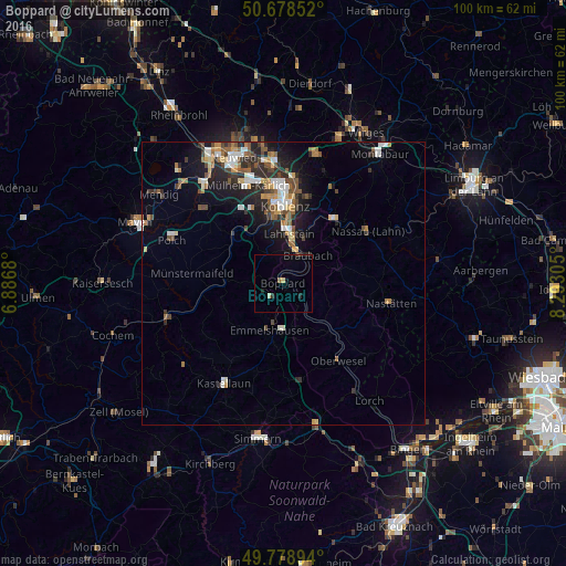
Analysis of Boppard night lights 2016
Square area 10x10 km:
 0%
0%90-99
0.13%80-89
0.94%70-79
0%60-69
0.27%50-59
0.27%40-49
0.53%30-39
0.27%20-29
1.87%10-19
0.8%0-9
94.92%Square area 50x50 km:
0.74%90-99
1.03%80-89
0.61%70-79
0.59%60-69
0.96%50-59
1.01%40-49
1.07%30-39
0.73%20-29
2.13%10-19
3.66%0-9
87.46%Clear (daylight) street map image can be seen on geolist.org.
Map coordinates:
50° 40' 42.7" North, 6° 53' 12.5" East
50° 13' 51.1" North, 7° 35' 23.7" East
49° 46' 44.2" North, 8° 17' 35" East
Some cities around Boppard sort by population:
• Koblenz
13.7 km =8.5 mi,  356°
356°
• Lahnstein
7.9 km =4.9 mi,  13°
13°
• Mülheim-Kärlich
18.3 km =11.4 mi,  339°
339°
• Bad Ems
14.6 km =9.1 mi,  37°
37°
• Vallendar
18.5 km =11.5 mi, 7°
• Kastellaun
20.9 km =13 mi,  210°
210°
• Ochtendung
19.8 km =12.3 mi,  312°
312°
• Nassau
17.6 km =10.9 mi,  58°
58°
2946366 (p: 16,215)
Sources (retrieved 2019-11-25):
» Earth at Night: Flat Maps 2012, 2016