Bassum night lights from space
Night Light of Bassum (Lower Saxony) from space (Germany) Src. Average luminocity for 10x10km area is 0.4975% and for 50x50km: 4.4471%.
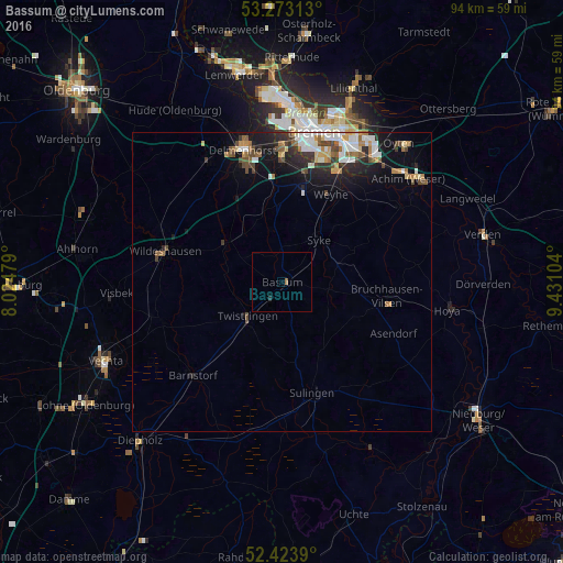
Analysis of Bassum night lights 2016
Square area 10x10 km:
 0%
0%90-99
0%80-89
0%70-79
0%60-69
0.51%50-59
0%40-49
0%30-39
0%20-29
0.51%10-19
0%0-9
98.99%Square area 50x50 km:
0.75%90-99
0.84%80-89
0.3%70-79
0.51%60-69
0.62%50-59
0.53%40-49
0.82%30-39
0.46%20-29
1.23%10-19
2.97%0-9
90.96%Clear (daylight) street map image can be seen on geolist.org.
Map coordinates:
53° 16' 23.3" North, 8° 1' 29.2" East
52° 51' 2.1" North, 8° 43' 40.5" East
52° 25' 26" North, 9° 25' 51.7" East
Some cities around Bassum sort by population:
• Stuhr
20.4 km =12.7 mi,  4°
4°
• Syke
9.4 km =5.8 mi,  42°
42°
• Wildeshausen
20.3 km =12.6 mi,  283°
283°
• Sulingen
19.3 km =12 mi,  163°
163°
• Twistringen
8.1 km =5 mi,  225°
225°
• Goldenstedt
21.1 km =13.1 mi,  250°
250°
• Bruchhausen-Vilsen
17.8 km =11.1 mi,  97°
97°
• Barnstorf
21.8 km =13.5 mi,  224°
224°
2952252 (p: 16,191)
Sources (retrieved 2019-11-25):
» Earth at Night: Flat Maps 2012, 2016