Bad Wildbad night lights from space
Night Light of Bad Wildbad (Baden-Württemberg) from space (Germany) Src. Average luminocity for 10x10km area is 0.9628% and for 50x50km: 9.6927%.
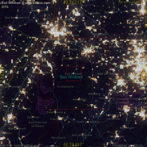
Analysis of Bad Wildbad night lights 2016
Square area 10x10 km:
 0%
0%90-99
0%80-89
0%70-79
0.6%60-69
0%50-59
0%40-49
0.45%30-39
0.45%20-29
0.3%10-19
0%0-9
98.21%Square area 50x50 km:
0.66%90-99
1.16%80-89
0.72%70-79
1.19%60-69
1.34%50-59
1.71%40-49
1.52%30-39
1.49%20-29
2.49%10-19
10.72%0-9
77%Clear (daylight) street map image can be seen on geolist.org.
Map coordinates:
49° 12' 43.8" North, 7° 50' 50.2" East
48° 45' 2.6" North, 8° 33' 1.4" East
48° 17' 5.9" North, 9° 15' 12.7" East
Some cities around Bad Wildbad sort by population:
• Calw
14.5 km =9 mi,  106°
106°
• Gernsbach
15.4 km =9.6 mi,  278°
278°
• Birkenfeld
14.3 km =8.9 mi,  25°
25°
• Bad Liebenzell
13.4 km =8.3 mi,  78°
78°
• Schömberg
8 km =5 mi,  59°
59°
• Neuenbürg
11 km =6.8 mi,  17°
17°
• Bad Herrenalb
9.9 km =6.2 mi,  302°
302°
• Neubulach
14.6 km =9.1 mi,  133°
133°
2809025 (p: 9,565)
Sources (retrieved 2019-11-25):
» Earth at Night: Flat Maps 2012, 2016