Bad Münstereifel night lights from space
Night Light of Bad Münstereifel (North Rhine-Westphalia) from space (Germany) Src. Average luminocity for 10x10km area is 1.1805% and for 50x50km: 5.602%.
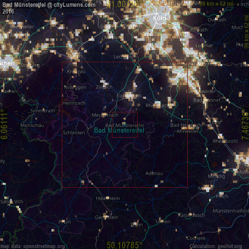
Analysis of Bad Münstereifel night lights 2016
Square area 10x10 km:
 0%
0%90-99
0%80-89
0%70-79
0.53%60-69
0%50-59
0.13%40-49
0.94%30-39
0%20-29
0%10-19
0%0-9
98.4%Square area 50x50 km:
0.76%90-99
0.99%80-89
0.41%70-79
0.51%60-69
0.64%50-59
0.78%40-49
0.77%30-39
1.09%20-29
1.38%10-19
3.72%0-9
88.94%Clear (daylight) street map image can be seen on geolist.org.
Map coordinates:
51° 0' 4.5" North, 6° 3' 40" East
50° 33' 24" North, 6° 45' 51.3" East
50° 6' 28.3" North, 7° 28' 2.5" East
Some cities around Bad Münstereifel sort by population:
• Euskirchen
11.7 km =7.3 mi,  7°
7°
• Mechernich
8.9 km =5.5 mi,  297°
297°
• Rheinbach
15.1 km =9.4 mi,  59°
59°
• Meckenheim
20.2 km =12.6 mi,  68°
68°
• Zulpich
17.2 km =10.7 mi,  333°
333°
• Kall
14.3 km =8.9 mi,  263°
263°
• Blankenheim
15.9 km =9.9 mi,  210°
210°
• Nettersheim
11.9 km =7.4 mi,  233°
233°
2953398 (p: 19,051)
Sources (retrieved 2019-11-25):
» Earth at Night: Flat Maps 2012, 2016