Bad Laasphe night lights from space
Night Light of Bad Laasphe (North Rhine-Westphalia) from space (Germany) Src. Average luminocity for 10x10km area is 0.0812% and for 50x50km: 1.3858%.
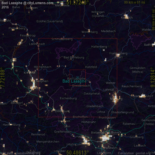
Analysis of Bad Laasphe night lights 2016
Square area 10x10 km:
 0%
0%90-99
0%80-89
0%70-79
0%60-69
0%50-59
0%40-49
0%30-39
0%20-29
0%10-19
0.56%0-9
99.44%Square area 50x50 km:
0.12%90-99
0.15%80-89
0.08%70-79
0.17%60-69
0.27%50-59
0.18%40-49
0.29%30-39
0.38%20-29
0.26%10-19
0.43%0-9
97.66%Clear (daylight) street map image can be seen on geolist.org.
Map coordinates:
51° 22' 20.7" North, 7° 43' 18.8" East
50° 55' 53" North, 8° 25' 30.1" East
50° 29' 10.1" North, 9° 7' 41.3" East
Some cities around Bad Laasphe sort by population:
• Bad Berleburg
13.6 km =8.5 mi,  350°
350°
• Biedenkopf
7.7 km =4.8 mi,  106°
106°
• Wetter
21.2 km =13.2 mi,  98°
98°
• Bad Endbach
20.8 km =12.9 mi,  165°
165°
• Erndtebrück
13.7 km =8.5 mi,  298°
298°
• Breidenbach
5.4 km =3.4 mi,  155°
155°
• Allendorf
20.5 km =12.7 mi,  57°
57°
• Battenberg
18 km =11.2 mi, 59°
2882091 (p: 15,184)
Sources (retrieved 2019-11-25):
» Earth at Night: Flat Maps 2012, 2016