Allendorf night lights from space
Night Light of Allendorf (Hesse) from space (Germany) Src. Average luminocity for 10x10km area is 1.8356% and for 50x50km: 1.0064%.
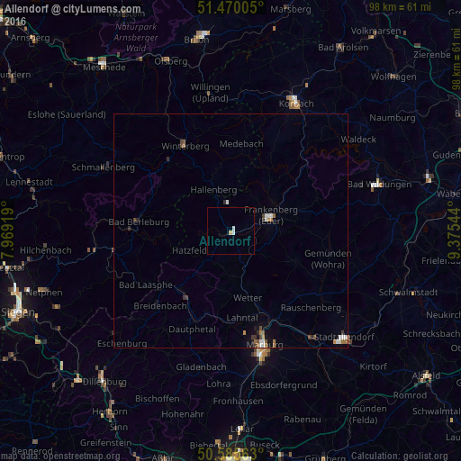
Analysis of Allendorf night lights 2016
Square area 10x10 km:
 0.94%
0.94%90-99
0.13%80-89
0%70-79
0.53%60-69
0%50-59
0%40-49
0%30-39
0%20-29
0%10-19
0%0-9
98.4%Square area 50x50 km:
0.17%90-99
0.18%80-89
0.01%70-79
0.09%60-69
0.2%50-59
0.12%40-49
0.19%30-39
0.17%20-29
0.15%10-19
0.25%0-9
98.48%Clear (daylight) street map image can be seen on geolist.org.
Map coordinates:
51° 28' 12.2" North, 7° 58' 9.1" East
51° 1' 47.8" North, 8° 40' 20.4" East
50° 35' 8.3" North, 9° 22' 31.6" East
Some cities around Allendorf sort by population:
• Bad Berleburg
19.7 km =12.2 mi,  277°
277°
• Frankenberg
9.5 km =5.9 mi,  70°
70°
• Bad Laasphe
20.5 km =12.7 mi,  237°
237°
• Winterberg
20.5 km =12.7 mi,  332°
332°
• Biedenkopf
16.5 km =10.3 mi,  217°
217°
• Wetter
14.6 km =9.1 mi,  165°
165°
• Medebach
18.7 km =11.6 mi,  7°
7°
• Battenberg
2.6 km =1.6 mi,  225°
225°
2958438 (p: 5,719)
Sources (retrieved 2019-11-25):
» Earth at Night: Flat Maps 2012, 2016