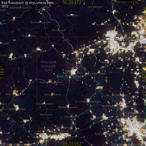
Bad Kreuznach night lights from space
Night Light of Bad Kreuznach (Rheinland-Pfalz) from space (Germany) Src. Average luminocity for 10x10km area is 18.7941% and for 50x50km: 5.9761%.
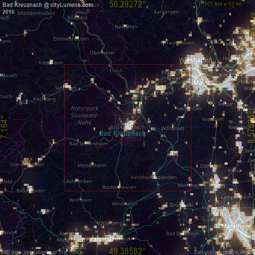
Analysis of Bad Kreuznach night lights 2016
Square area 10x10 km:
 4.01%
4.01%90-99
2.41%80-89
1.6%70-79
1.6%60-69
1.07%50-59
2.81%40-49
2.81%30-39
1.34%20-29
1.2%10-19
25.94%0-9
55.21%Square area 50x50 km:
0.56%90-99
0.72%80-89
0.66%70-79
0.72%60-69
0.71%50-59
0.88%40-49
1.06%30-39
1%20-29
1.3%10-19
5.64%0-9
86.77%Clear (daylight) street map image can be seen on geolist.org.
Map coordinates:
50° 17' 33.8" North, 7° 9' 50.4" East
49° 50' 29" North, 7° 52' 1.7" East
49° 23' 9" North, 8° 34' 12.9" East
Some cities around Bad Kreuznach sort by population:
• Ingelheim am Rhein
19.9 km =12.4 mi,  43°
43°
• Bingen am Rhein
14.1 km =8.8 mi,  9°
9°
• Alzey
20.7 km =12.9 mi,  120°
120°
• Geisenheim
17.5 km =10.9 mi,  24°
24°
• Rüdesheim am Rhein
15.8 km =9.8 mi, 15°
• Wörrstadt
18.4 km =11.4 mi,  87°
87°
• Ober-Saulheim
19.4 km =12.1 mi,  82°
82°
• Gau-Algesheim
16.7 km =10.4 mi, 39°
2953416 (p: 43,213)
Sources (retrieved 2019-11-25):
» Earth at Night: Flat Maps 2012, 2016