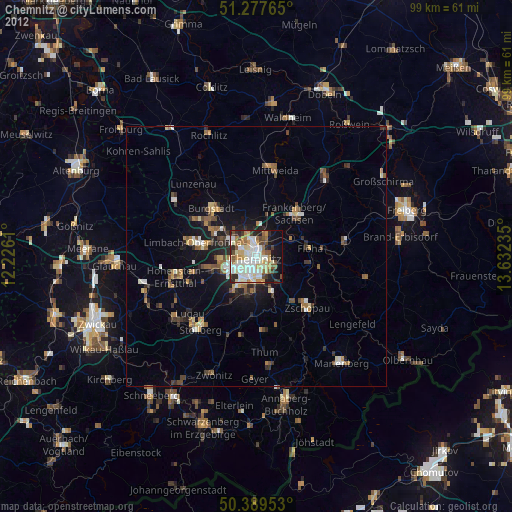
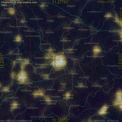
Chemnitz night lights from space
Night Light of Chemnitz (Saxony) from space (Germany) Src. Average luminocity for 10x10km area is 60.7493% and for 50x50km: 5.7233%.
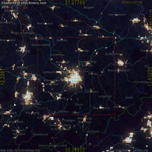

Analysis of Chemnitz night lights 2016
Square area 10x10 km:
 15.41%
90-99
18.63%80-89
10.64%70-79
3.22%60-69
6.16%50-59
5.74%40-49
3.22%30-39
4.76%20-29
14.57%10-19
13.45%0-9
4.2%Square area 50x50 km:
0.78%90-99
1.05%80-89
0.79%70-79
0.41%60-69
0.65%50-59
0.8%40-49
0.69%30-39
0.67%20-29
1.72%10-19
3.22%0-9
89.21%Clear (daylight) street map image can be seen on geolist.org.
Map coordinates:
51° 16' 39.5" North, 12° 13' 34" East
50° 50' 8.5" North, 12° 55' 45.2" East
50° 23' 22.3" North, 13° 37' 56.5" East
Some cities around Chemnitz sort by population:
• Limbach-Oberfrohna
12 km =7.5 mi,  282°
282°
• Frankenberg
11.6 km =7.2 mi,  42°
42°
• Burgstädt
12.2 km =7.6 mi,  314°
314°
• Flöha
10.4 km =6.5 mi,  77°
77°
• Neukirchen
7.6 km =4.7 mi,  214°
214°
• Burkhardtsdorf
11.4 km =7.1 mi,  184°
184°
• Jahnsdorf
11.4 km =7.1 mi, 207°
• Niederwiesa
7 km =4.3 mi,  60°
60°
2940132 (p: 247,220)
Sources (retrieved 2019-11-25):
» NASA, Earths city lights 1995
» NASA city lights 2003
» Earth at Night: Flat Maps 2012, 2016