Burkhardtsdorf night lights from space
Night Light of Burkhardtsdorf (Saxony) from space (Germany) Src. Average luminocity for 10x10km area is 6.639% and for 50x50km: 6.5891%.
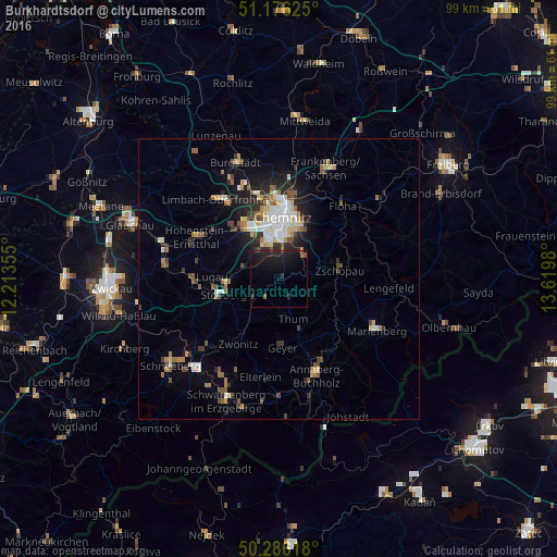
Analysis of Burkhardtsdorf night lights 2016
Square area 10x10 km:
 0%
0%90-99
0%80-89
0%70-79
0%60-69
0.4%50-59
2.01%40-49
0.8%30-39
0.27%20-29
5.08%10-19
16.44%0-9
75%Square area 50x50 km:
0.86%90-99
1.1%80-89
0.83%70-79
0.48%60-69
0.92%50-59
1.02%40-49
0.82%30-39
0.75%20-29
1.89%10-19
3.34%0-9
87.98%Clear (daylight) street map image can be seen on geolist.org.
Map coordinates:
51° 10' 34.5" North, 12° 12' 48.8" East
50° 43' 60" North, 12° 55' 0" East
50° 17' 10.2" North, 13° 37' 11.3" East
Some cities around Burkhardtsdorf sort by population:
• Chemnitz
11.4 km =7.1 mi,  4°
4°
• Stollberg
9.9 km =6.2 mi,  254°
254°
• Zschopau
11.4 km =7.1 mi,  81°
81°
• Thalheim
5.9 km =3.7 mi,  232°
232°
• Neukirchen
6.2 km =3.9 mi,  326°
326°
• Jahnsdorf
4.6 km =2.9 mi,  286°
286°
• Thum
7.4 km =4.6 mi,  160°
160°
• Ehrenfriedersdorf
10.1 km =6.3 mi, 158°
2940993 (p: 7,067)
Sources (retrieved 2019-11-25):
» Earth at Night: Flat Maps 2012, 2016