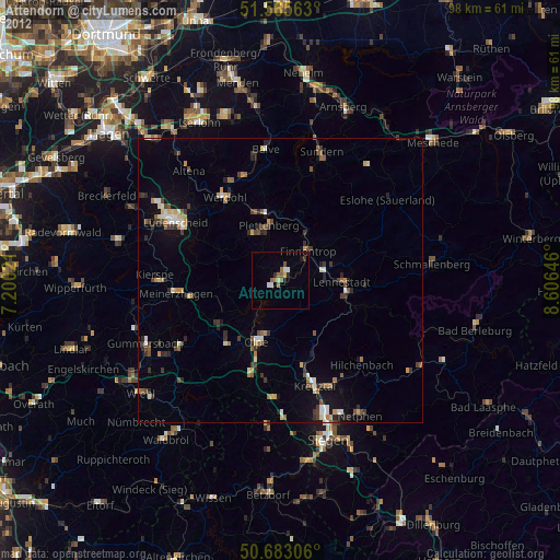
Attendorn night lights from space
Night Light of Attendorn (North Rhine-Westphalia) from space (Germany) Src. Average luminocity for 10x10km area is 4.1658% and for 50x50km: 3.2328%.
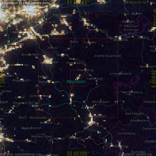
Analysis of Attendorn night lights 2016
Square area 10x10 km:
 0.13%
0.13%90-99
0.4%80-89
0%70-79
1.07%60-69
1.07%50-59
0.53%40-49
1.07%30-39
0.8%20-29
0.53%10-19
0.53%0-9
93.85%Square area 50x50 km:
0.27%90-99
0.37%80-89
0.25%70-79
0.43%60-69
0.46%50-59
0.52%40-49
0.57%30-39
0.49%20-29
0.47%10-19
2.15%0-9
94.02%Clear (daylight) street map image can be seen on geolist.org.
Map coordinates:
51° 33' 56.3" North, 7° 12' 0.8" East
51° 7' 35.2" North, 7° 54' 12" East
50° 40' 59" North, 8° 36' 23.3" East
Some cities around Attendorn sort by population:
• Plettenberg
9.5 km =5.9 mi,  346°
346°
• Lennestadt
11.5 km =7.1 mi,  95°
95°
• Olpe
11.4 km =7.1 mi,  198°
198°
• Werdohl
17.7 km =11 mi,  327°
327°
• Finnentrop
6.7 km =4.2 mi,  46°
46°
• Kirchhundem
13.7 km =8.5 mi,  109°
109°
• Drolshagen
14.6 km =9.1 mi,  218°
218°
• Herscheid
12.6 km =7.8 mi,  297°
297°
2954932 (p: 24,773)
Sources (retrieved 2019-11-25):
» Earth at Night: Flat Maps 2012, 2016