Lüdenscheid night lights from space
Night Light of Lüdenscheid (North Rhine-Westphalia) from space (Germany) Src. Average luminocity for 10x10km area is 26.1176% and for 50x50km: 9.4199%.

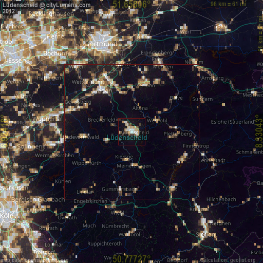
Analysis of Lüdenscheid night lights 2016
Square area 10x10 km:
 4.9%
4.9%90-99
4.62%80-89
2.38%70-79
4.76%60-69
2.66%50-59
2.52%40-49
3.08%30-39
0.28%20-29
0.56%10-19
32.21%0-9
42.02%Square area 50x50 km:
0.78%90-99
1.12%80-89
0.86%70-79
1.17%60-69
1.37%50-59
1.34%40-49
1.55%30-39
1.41%20-29
2.92%10-19
9.92%0-9
77.56%Clear (daylight) street map image can be seen on geolist.org.
Map coordinates:
51° 39' 29" North, 6° 55' 27" East
51° 13' 11.2" North, 7° 37' 38.3" East
50° 46' 38.2" North, 8° 19' 49.5" East
Some cities around Lüdenscheid sort by population:
• Altena
8.9 km =5.5 mi,  21°
21°
• Werdohl
10.7 km =6.6 mi,  65°
65°
• Kierspe
9.9 km =6.2 mi,  194°
194°
• Halver
9.7 km =6 mi,  247°
247°
• Schalksmühle
7.3 km =4.5 mi,  288°
288°
• Breckerfeld
11.9 km =7.4 mi, 291°
• Herscheid
9.3 km =5.8 mi,  119°
119°
• Nachrodt-Wiblingwerde
10.8 km =6.7 mi,  356°
356°
2875457 (p: 79,386)
Sources (retrieved 2019-11-25):
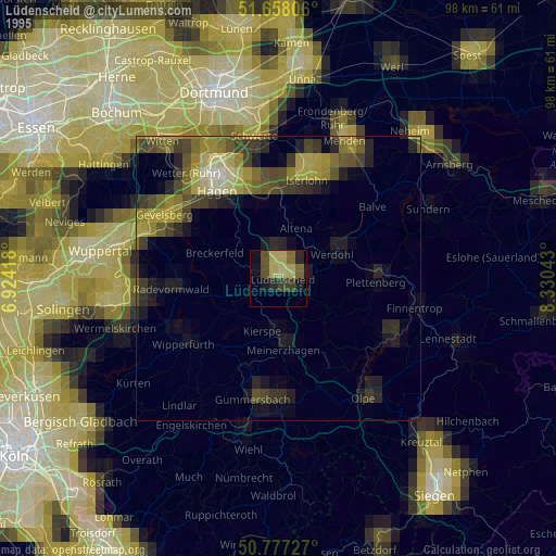
» NASA, Earths city lights 1995
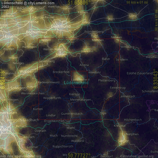
» NASA city lights 2003
» Earth at Night: Flat Maps 2012, 2016